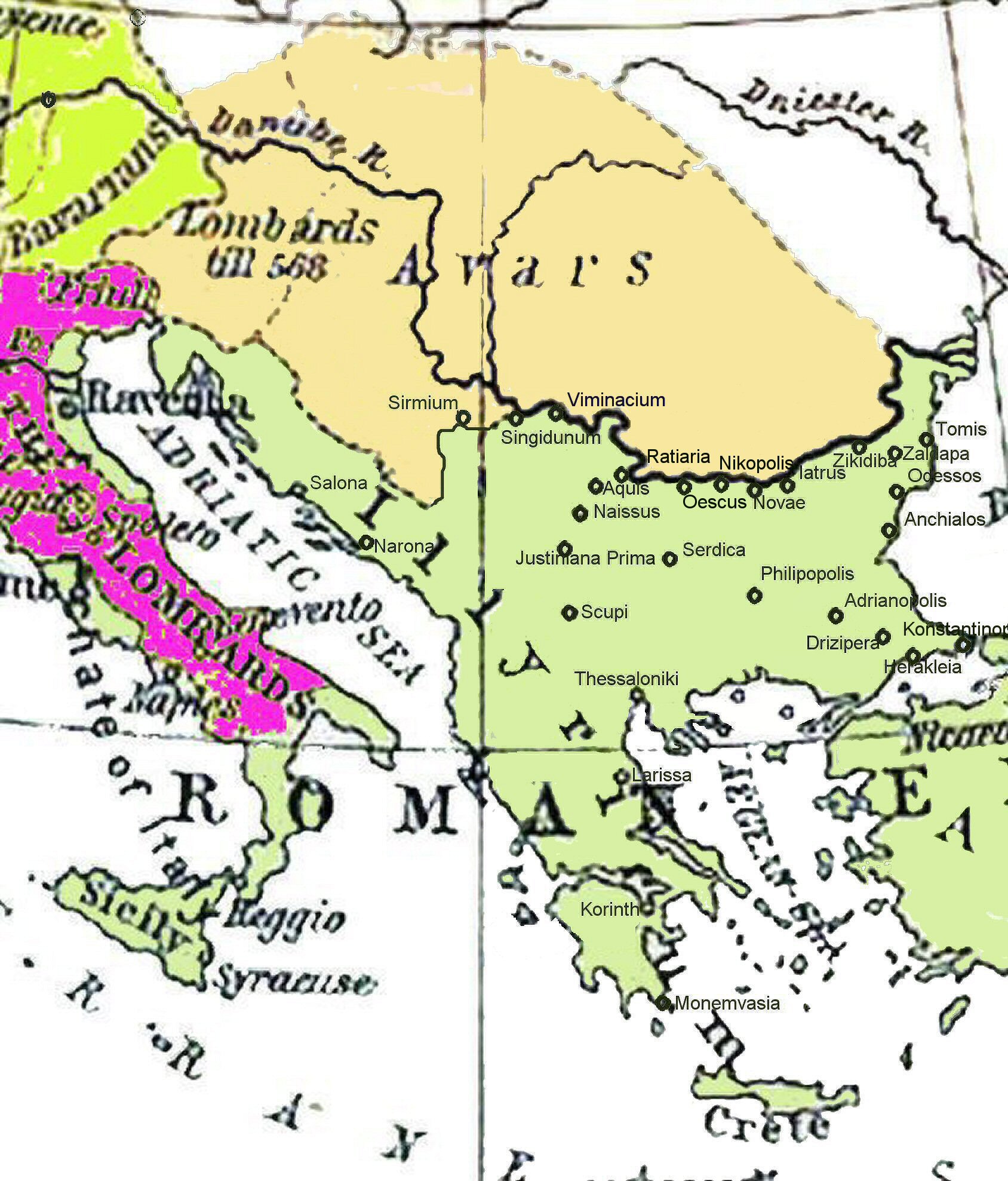
Historical map of the Balkans around 582-612 AD
Forfatter/Opretter:
William Shepherd R. (1871-1934); Wolf Halama (nur der hier überarbeitete Kartenausschnitt)
Kredit:
Ursprung Shepherd, William: Historical Atlas. New York: Henry Holt and Company, 1911
Shortlink:
kilde:
størrelse:
1688 x 1977 Pixel (487589 Bytes)
beskrivelse:
Historical map of the Balkans around 582-612 AD showing the Avar Khaganate, Byzantine (Eastern Roman) Empire.
Licens:
Public domain
Yderligere oplysninger om licens til billedet kan findes her. Sidste ændring: Thu, 12 Jan 2023 13:32:01 GMT