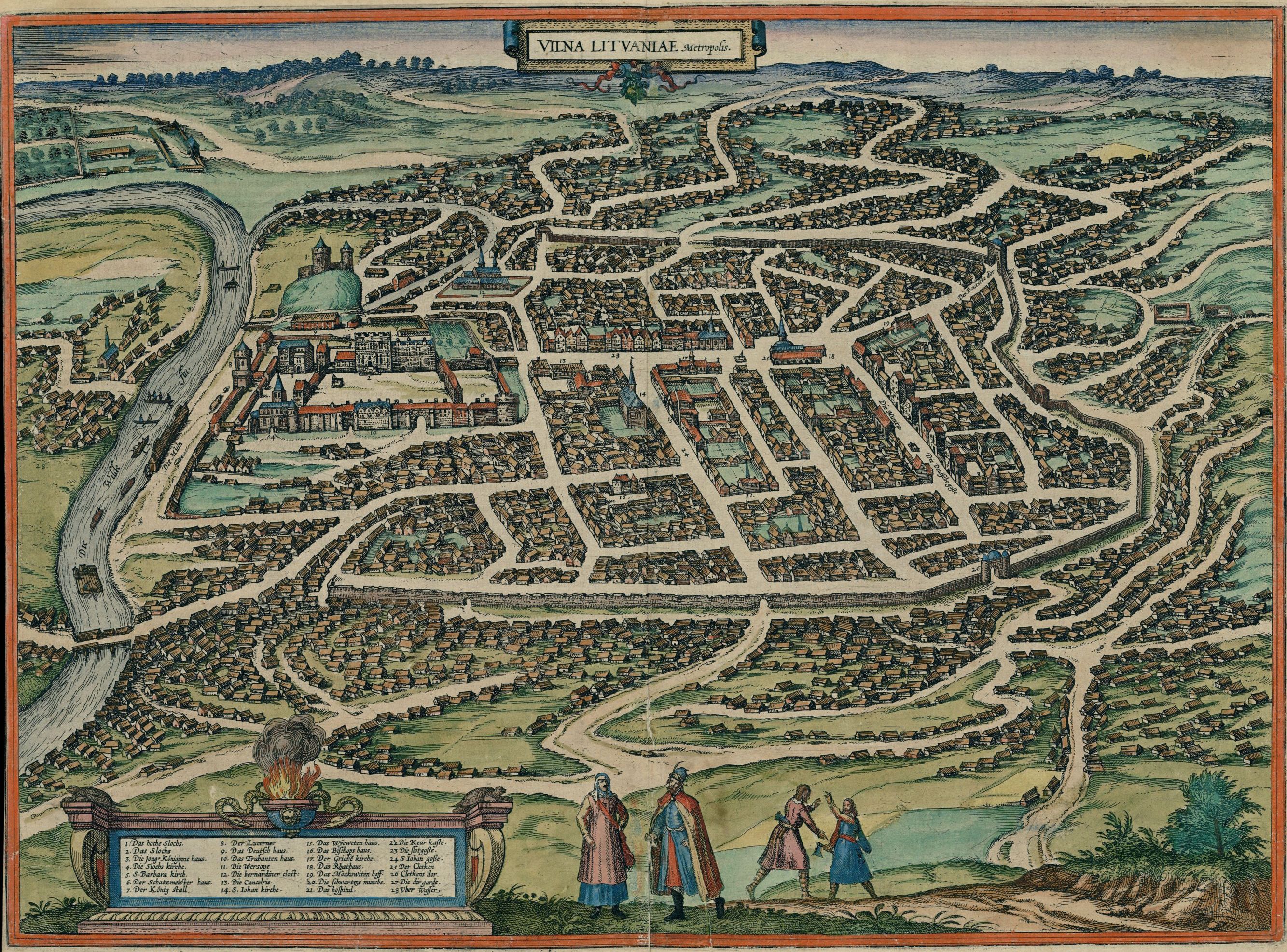
Vilnius 1576
Forfatter/Opretter:
German cartographer and church diplomat G. Braun (1541-1622) and his assistants
Kredit:
Original publication: Cities of the World (Civitates orbis terrarum. Koeln, 1581. T.3)
Digital file: Historic Cities Center of the Department of Geography, the Hebrew University of Jerusalem and the Jewish National and University Library.
Shortlink:
kilde:
størrelse:
2667 x 1973 Pixel (1842666 Bytes)
beskrivelse:
Map of Vilnius in 1576
Licens:
Public domain
Kommentar på licensen:
public domain (pd-old)
Yderligere oplysninger om licens til billedet kan findes her. Sidste ændring: Sat, 16 Dec 2023 08:06:13 GMT