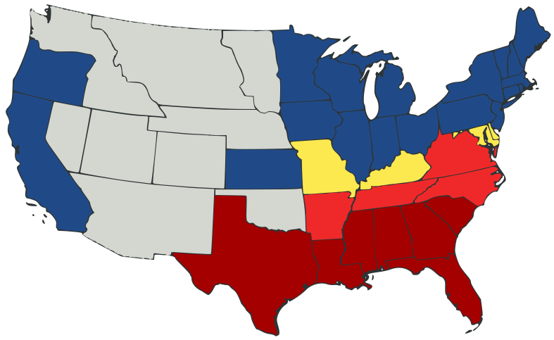
US Secession map 1861
Forfatter/Opretter:
Attribution:
Billedet er tagget "Attribution Required", men der blev ikke angivet nogen tilskrivningsoplysninger. Attributionsparameteren blev sandsynligvis udeladt ved brug af MediaWiki-skabelonen til CC-BY-licenserne. Forfattere og ophavsmænd finder et eksempel på korrekt brug af eksempel her. her.
Shortlink:
kilde:
størrelse:
787 x 483 Pixel (113216 Bytes)
beskrivelse:
United States map of 1861, showing affiliation of states and territories regarding secession from the Union at the start of the American Civil War.
Legend:
States that seceded before April 15, 1861
States that seceded after April 15, 1861
States that permitted slavery, but did not secede
States of the Union where slavery was banned
U.S. territories, under Union Army control
Licens:
Licensbetingelser:
Creative Commons Attribution-Share Alike 3.0
Yderligere oplysninger om licens til billedet kan findes her. Sidste ændring: Wed, 22 Nov 2023 04:18:49 GMT
