Scandinavia.TMO2003050
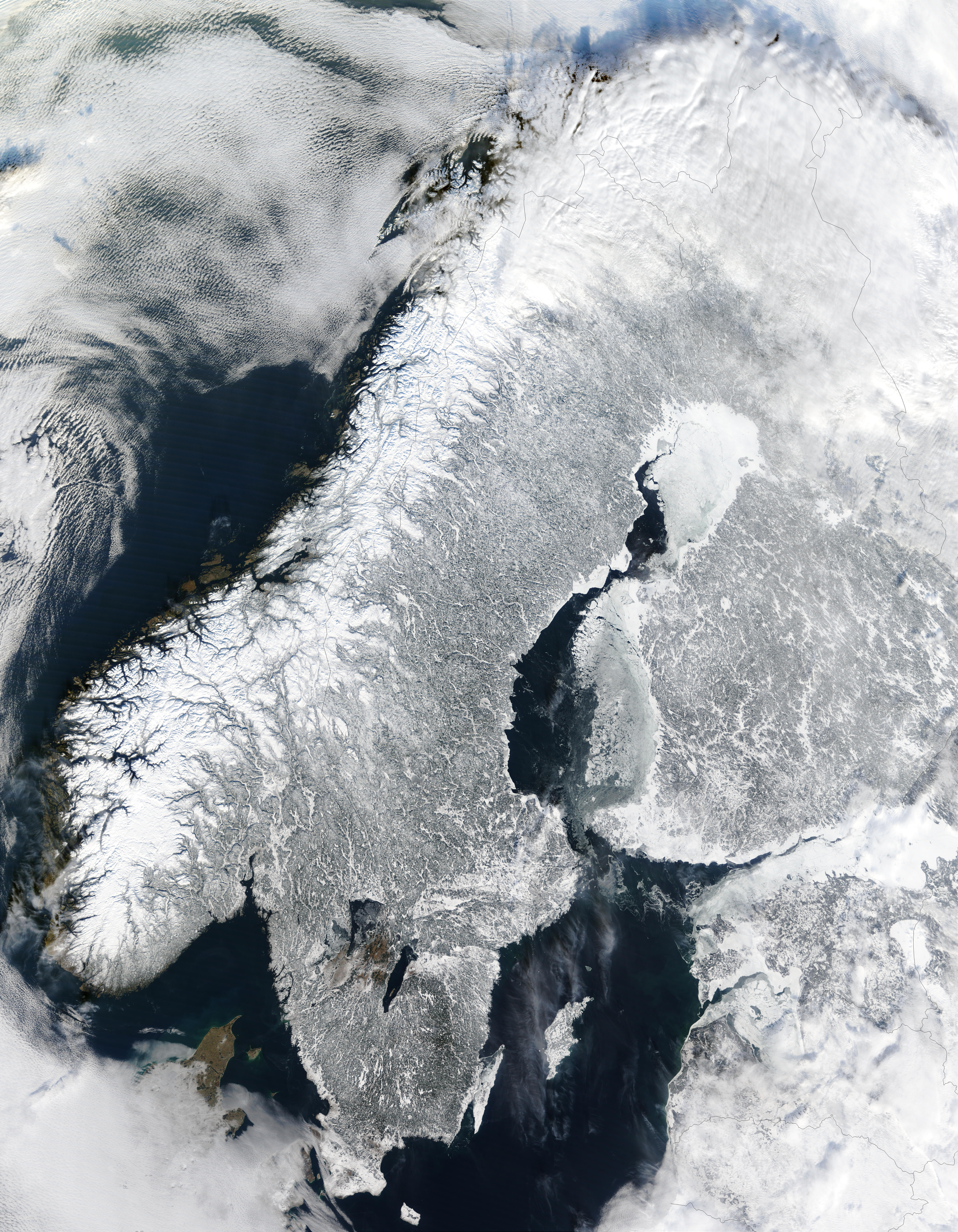
The Moderate Resolution Imaging Spectroradiometer (MODIS) instrument aboard NASA’s Terra satellite captured the above image of the Scandinavian Peninsula on February 19, 2003.
With a landscape largely shaped by glaciers over the last ice age, the Scandinavian Peninsula is as picturesque in the winter as it is cold. Along the left side of the peninsula, one can see the jagged inlets, known as fjords, lining Norway’s coast. Many of these fjords are well over 2,000 feet (610 meters) deep and were carved out by extremely heavy, thick glaciers that formed during the last ice age. The glaciers ran off the mountains and scoured troughs into Norway’s coastline with depths that reached well below sea level. When the glaciers melted, the seawater rushed into these deep troughs to form the fjords. The deepest fjord on Norway’s coast, known as Sogn Fjord, lies in southwest Norway and is 4,291 feet (1,308 m) deep.
Yderligere oplysninger om licens til billedet kan findes her. Sidste ændring: Mon, 11 Dec 2023 05:56:11 GMT