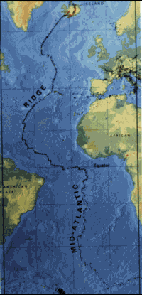
Mid-atlantic ridge map
Forfatter/Opretter:
originally uploaded on the English wikipedia: 14:51, 21 October 2003 . . JamesDay (Talk / contribs) . . 200×415 (21,177 bytes) (mid-Atlantic ridge map)
Kredit:
Shortlink:
kilde:
størrelse:
200 x 415 Pixel (21177 Bytes)
beskrivelse:
small image showing the location of the Mid-Atlantic ridge
Licens:
Public domain
Kommentar på licensen:
Copyright: public domain. US Geological Survey image. Copyright statement: [2]
"Information presented on this website is considered public information and may be distributed or copied. Use of appropriate byline/photo/image credit is requested."Yderligere oplysninger om licens til billedet kan findes her. Sidste ændring: Fri, 22 Mar 2024 01:16:47 GMT