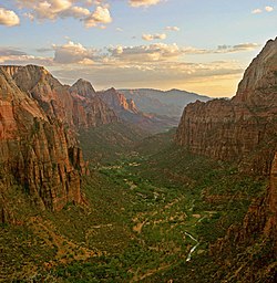
Zion National Park
 For alternative betydninger, se Zion (flertydig). (Se også artikler, som begynder med Zion)
Zion Nationalpark er placeret nær Springdale, Utah i det sydvestlige USA. Den udgør et areal på 593 km² og har et laveste punkt i 1128 meters højde ved Coalpits Wash og et højeste punkt på 2.660 meter ved Horse Ranch Mountain. Området blev i 1909 rubriceret som Mukuntweap Nationalmonument, inden det i 1919 fik navnet Zion Nationalpark.
Zion er et gammelt hebraisk ord og betyder 'helligt sted' eller 'sted man flygter til'.
Eksterne kilder/henvisninger
| Spire |
Koordinater: 37°13′7″N 112°57′29″V / 37.21861°N 112.95806°V
|
Medier brugt på denne side
Logo of the United States National Park Service, an agency of the United States Department of the Interior. This version is shaded to look as if it has been carved out of wood or rock. The elements on the logo represent the major facets of the national park system. The Sequoia tree and bison represent vegetation and wildlife, the mountains and water represent scenic and recreational values, and the arrowhead represents historical and archeological values. The bison is also the symbol of the Department of the Interior. The logo became the official logo on July 20, 1951, replacing the previous emblem of a Sequoia cone, and has been used ever since. The design was slightly updated in 2001, and a few different renderings are used today. For more information, see here and here.[dead link]
(c) Lokal_Profil, CC BY-SA 2.5
Map showing Mainland USA ("lower 48") with a superimposed US flag.
Forfatter/Opretter: Diliff, Licens: CC BY-SA 3.0
Zion Canyon at sunset in Zion National Park as seen from Angels Landing looking south.


