Voinjama
| Voinjama | |
|---|---|
 | |
| Overblik | |
| Land | |
| Oversigtskort | |
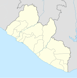
Voinjama er en by i det nordlige Liberia, beliggende tæt ved grænsen til nabolandet Guinea. Byen har et indbyggertal (pr. 2008) på cirka 27.000.
| ||||||||||
|
| Spire |
Medier brugt på denne side
Forfatter/Opretter: Uwe Dedering, Licens: CC BY-SA 3.0
Location map of Liberia Equirectangular projection. Strechted by 101.0%. Geographic limits of the map:
- N: 8.8° N
- S: 4.0° N
- W: -11.8° E
- E: -7.0° E


