Villamanta
| Villamanta | |||||
|---|---|---|---|---|---|
| |||||
 | |||||
| Overblik | |||||
| Land | |||||
| Borgmester | Pedro Luis Dorado del Álamo[1] | ||||
| Autonom region | |||||
| Provins | |||||
| Amt | Sierra Oeste de Madrid | ||||
| Postnr. | 28610 | ||||
| Nummerpladebogstav(er) | M | ||||
| Demografi | |||||
| Indbyggere | 2.823 (2024) | ||||
| - Areal | 63,0 km² | ||||
| - Befolkningstæthed | 44,8 pr. km² | ||||
| Andet | |||||
| Tidszone | UTC+1 | ||||
| Højde m.o.h. | 561 m | ||||
| Hjemmeside | www.villamanta.es | ||||
| Oversigtskort | |||||
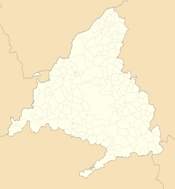
| Kommunens beliggenhed i Madrid-regionen | |||||
(c) Miguillen, CC BY-SA 3.0 Villamanta | |||||
Villamanta er en by og kommune i det centrale Spanien i Madrid-regionen. Den har et indbyggertal på 2.823 (2024) indbyggere.
Referencer
Eksterne henvisninger
| Spire |
Medier brugt på denne side
Forfatter/Opretter: See file history, Licens: CC0
Flag of the Community of Madrid (Spain)
Forfatter/Opretter: Roi González Villa (Vivaelcelta), Licens: CC BY-SA 3.0
Location map of Spain
Equirectangular projection, N/S stretching 130 %. Geographic limits of the map:
- N: 44.4° N
- S: 34.7° N
- W: 9.9° W
- E: 4.8° E
Forfatter/Opretter: jynus, Licens: CC BY-SA 3.0
Silhouette of Spain with Spanish Flag.
Forfatter/Opretter: Tschubby, Licens: CC BY-SA 3.0
Gemeinde Villamanta
Forfatter/Opretter: SanchoPanzaXXI(Taller de Heráldica y Vexilología in the Spanish Wikipedia
Escudo municipal de Villamanta (Madrid): Partido. Primero, en gules, un acueducto de dos órdenes, de plata, mazonado de sable y puesto sobre diez peñascos, de lo mismo. Segundo, cuartelado, primero y cuarto, de plata, un lobo pasante de sable; segundo y tercero, en zur, una flor de lis, de oro.Manuel Rodríguez de Maribona y Dávila, Heráldica municipal de la Comunidad de Madrid, Ed. Colegio Heráldico de España y de las Indias, Madrid, 1997. ISBN 84950016B2
Forfatter/Opretter: Rodelar, Licens: CC BY-SA 4.0
Plaza del Rey Juan Carlos I, Villamanta (Madrid, España).


