Venezuelas delstater
 |
Denne artikel indgår i serien: Venezuela |
|
| Bolivarisme |
|---|
|
| Valg |
|
|
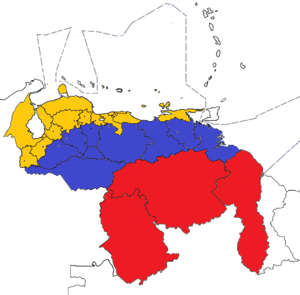
Venezuela er inddelt i 23 delstater (estados), et hovedstadsdistrikt (Distrito Capital) og et føderalt distrikt (Dependencia Federal), der består af en større række øer, samt Guayana Esequiba (opnået i forbindelse med grænsestridigheder med Guyana). Venezuela er yderligere underinddelt i 335 kommuner (municipios). Disse er underinddelt i over tusind sogn (parroquias). Staterne er grupperet i ni administrative regioner (regiones administrativas).
Historie
Før den føderale krig (1859-1863) var Venezuela inddelt i såkaldte provinser. Efter denne krig fulgte mange teritorielle ændringer, som endte i de 23 nuværende delstater. På trods af de mange ændringer forblev delstaterne stort set det samme, men 3 nye stater er blevet dannet inden for nyere tid. Dette gælder Delta Amacuro og Amazonas (Begge hørte tidligere under delstaten Bolívar) samt Vargas.
Delstaterne
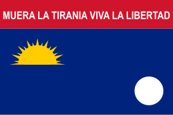
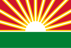
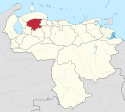
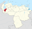
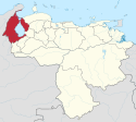
Herunder er en liste over Venezuelas 23 delstater plus hovedstadsdistriktet. Staterne er listede sammen med deres emblemer, data og beliggenhed.
| Flag | Våbenskjold | Stater | Hovedstad | Indbyggertal (2007 anslået) | Areal | Region | Beliggenhed |
|---|---|---|---|---|---|---|---|
| Amazonas | Puerto Ayacucho | 142.200 | 180.145 km² | Guayana | |||
| Anzoátegui | Barcelona | 1.477.900 | 43.300 km² | Nord-øst | |||
| Apure | San Fernando de Apure | 473.900 | 76.500 km² | Llanos | |||
| Aragua | Maracay | 1.665.200 | 7.014 km² | Central | |||
| Barinas | Barinas | 756.600 | 35.200 km² | Andes | |||
| Bolívar | Ciudad Bolívar | 1.534.800 | 238.000 km² | Guayana | |||
| Carabobo | Valencia | 2.227.000 | 4.650 km² | Central | |||
| Cojedes | San Carlos | 300.300 | 14.800 km² | Central | |||
| Delta Amacuro | Tucupita | 152.700 | 40.200 km² | Guayana | |||
| Distrito Capital | Caracas | 5.240.320 | 433 km² | Hovedstad | |||
| Falcón | Santa Ana de Coro | 901.500 | 24.800 km² | Central-vest | |||
| Guárico | San Juan De Los Morros | 745.100 | 64.986 km² | Llanos | |||
| Lara | Barquisimeto. Venezuela | 1.795.100 | 19.800 km² | Central-vest | |||
| Mérida | Mérida | 843.800 | 11.300 km² | Andes | |||
| Miranda | Los Teques | 2.857.900 | 7.950 km² | Hovedstad | |||
| Monagas | Maturín | 855.300 | 28.930 km² | Nord-øst | |||
| Nueva Esparta | La Asunción | 436.900 | 1.150 km² | Øområde | |||
| Portuguesa | Guanare | 873.400 | 15.200 km² | Central-vest | |||
| Sucre | Cumaná | 916.600 | 11.800 km² | Nord-øst | |||
| Táchira | San Cristóbal | 1.177.300 | 11.100 km² | Andes | |||
| Trujillo | Trujillo | 711.400 | 7.400 km² | Andes | |||
| Vargas | La Güaira | 332.900 | 1.496 km² | Hovedstad | |||
| Yaracuy | San Felipe | 597.700 | 7.100 km² | Central-vest | |||
| Zulia | Maracaibo | 3.620.200 | 63.100 km² | Zulia |
Efter indbyggertal
Delstater sorteret efter indbyggertal.
| # | Delstat | Indbyggertal (2007 estimeret) | % |
|---|---|---|---|
| 1 | Zulia | 3.620.200 | 13,17 |
| 2 | Miranda | 2.857.900 | 10,40 |
| 3 | Carabobo | 2.227.000 | 8,10 |
| 4 | Caracas | 2.085.500 | 7,59 |
| 5 | Lara | 1.795.100 | 6,53 |
| 6 | Aragua | 1.665.200 | 6,06 |
| 7 | Bolívar | 1.534.800 | 5,58 |
| 8 | Anzoátegui | 1.477.900 | 5,38 |
| 9 | Táchira | 1.177.300 | 4,28 |
| 10 | Sucre | 916.600 | 3,34 |
| 11 | Falcón | 901.500 | 3,28 |
| 12 | Portuguesa | 873.400 | 3,18 |
| 13 | Monagas | 855.300 | 3,11 |
| 14 | Mérida | 843.800 | 3,07 |
| 15 | Barinas | 756.600 | 2,75 |
| 16 | Guárico | 745.100 | 2,71 |
| 17 | Trujillo | 711.400 | 2,59 |
| 18 | Yaracuy | 597.700 | 2,17 |
| 19 | Apure | 473.900 | 1,72 |
| 20 | Nueva Esparta | 436.900 | 1,59 |
| 21 | Vargas | 332.900 | 1,21 |
| 22 | Cojedes | 300.300 | 1,09 |
| 23 | Delta Amacuro | 152.700 | 0,56 |
| 24 | Amazonas | 142.200 | 0,52 |
| I alt | 27.481.200 | 100% |
Efter areal
Delstater sorteret efter areal.
| # | Delstat | Areal (km²) | % |
|---|---|---|---|
| 1 | Bolívar | 238.000 | 25,97% |
| 2 | Amazonas | 180.145 | 19,66% |
| 3 | Apure | 76.500 | 8,35% |
| 4 | Guárico | 64.986 | 7,09% |
| 5 | Zulia | 63.100 | 6,89% |
| 6 | Anzoátegui | 43.300 | 4,73% |
| 7 | Delta Amacuro | 40.200 | 4,39% |
| 8 | Barinas | 35.200 | 3,84% |
| 9 | Monagas | 28.930 | 3,16% |
| 10 | Falcón | 24.800 | 2,71% |
| 11 | Lara | 19.800 | 2,16% |
| 12 | Portuguesa | 15.200 | 1,66% |
| 13 | Cojedes | 14.800 | 1,62% |
| 14 | Sucre | 11.800 | 1,29% |
| 15 | Mérida | 11.300 | 1,23% |
| 16 | Táchira | 11.100 | 1,21% |
| 17 | Miranda | 7.950 | 0,87% |
| 18 | Trujillo | 7.400 | 0,81% |
| 19 | Yaracuy | 7.100 | 0,77% |
| 20 | Aragua | 7.014 | 0,77% |
| 21 | Carabobo | 4.650 | 0,51% |
| 22 | Vargas | 1.496 | 0,16% |
| 23 | Nueva Esparta | 1.150 | 0,13% |
| 24 | Caracas | 433 | 0.05% |
| I alt | 916.354 | 100% |
Efter befolkningstæthed
Delstater sorteret efter befolkningstæthed.
| # | Delstat | Indbyggertal | Areal (km²) | Befolkningstæthed |
|---|---|---|---|---|
| 1 | Caracas | 2.085.500 | 433 | 4.816,4 |
| 2 | Carabobo | 2.227.000 | 4.650 | 478,9 |
| 3 | Nueva Esparta | 436.900 | 1.150 | 379,9 |
| 4 | Miranda | 2.857.900 | 7.950 | 359,5 |
| 5 | Aragua | 1.665.200 | 7.014 | 237,4 |
| 6 | Vargas | 332.900 | 1.496 | 222,5 |
| 7 | Táchira | 1.177.300 | 11.100 | 106,1 |
| 8 | Trujillo | 711.400 | 7.400 | 96,1 |
| 9 | Lara | 1.795.100 | 19.800 | 90,7 |
| 10 | Yaracuy | 597.700 | 7.100 | 84,2 |
| 11 | Sucre | 916.600 | 11.800 | 77,7 |
| 12 | Mérida | 843.800 | 11.300 | 74,7 |
| 13 | Portuguesa | 873.400 | 15.200 | 57,5 |
| 14 | Zulia | 3.620.200 | 63.100 | 57,4 |
| 15 | Falcón | 901.500 | 24.800 | 36,4 |
| 16 | Anzoátegui | 1.477.900 | 43.300 | 34,1 |
| 17 | Monagas | 855.300 | 28.930 | 29,6 |
| 18 | Barinas | 756.600 | 35.200 | 21,5 |
| 19 | Cojedes | 300.300 | 14.800 | 20,3 |
| 20 | Guárico | 745.100 | 64.986 | 11,5 |
| 21 | Bolívar | 1.534.800 | 238.000 | 6,4 |
| 22 | Apure | 473.900 | 76.500 | 6,2 |
| 23 | Delta Amacuro | 152.700 | 40.200 | 3,8 |
| 24 | Amazonas | 142.200 | 180.145 | 0,8 |
| I alt | 27.481.200 | 916.354 | 30,0 |
Medier brugt på denne side
Forfatter/Opretter: TUBS
Location of state xy (see filename) in Venezuela.
Forfatter/Opretter:
- File:Bandera naval de Miranda.jpg: Ninane
- derivative work: Huhsunqu (talk)
Flag of Falcon State, Venezuela. Adopted 2006.
Coat of arms of Caracas, Venezuela
Flag of Sucre State since 2002. Heraldry are in bad quality. The flag has fifteen municipalities and fifteen stars.
Forfatter/Opretter: Alfredosfloresp, Licens: CC BY-SA 4.0
Escudo del Estado Yaracuy, Venezuela.
Forfatter/Opretter: TUBS
Location of state xy (see filename) in Venezuela.
Forfatter/Opretter: TUBS
Location of state xy (see filename) in Venezuela.
Forfatter/Opretter: Josedar, Licens: CC BY-SA 4.0
Coat of arms of Cojedes state
Forfatter/Opretter: TUBS
Location of state xy (see filename) in Venezuela.
Flag of Lara State
Flag of Aragua State of Venezuela
Forfatter/Opretter: TUBS
Location of state xy (see filename) in Venezuela.
Forfatter/Opretter: Domie (Image:Barinasvlag.png) ; bayo (SVG conversion), Licens: CC BY-SA 3.0
Flag of Barinas State of Venezuela
Forfatter/Opretter: TUBS
Location of the Capital District in Venezuela.
Forfatter/Opretter: Wilfredor, Licens: CC BY-SA 4.0
- Attributes.—
The Meridenian Coat of Arms presents a compound shape tierced per fess. The Quarter of the Chief enameled in Or (yellow) shows three panoplies: two swords crossed in saltire at dexter; a cannon with a mast with open sails at center and on the sinister an arrow crossed with a rifle rebounded by a Phrygian Cap, all in its colors. The Central Quarter enameled in Azure (blue) presents a snow crested mountain with a lake where a boat is sailing at dexter and a prairie at sinister with a Silver (white) horse running from dexter to sinister but looking to the dexter. The Quarter of the Base enameled in Gules (red) charges two bundles: one of sugar cane at dexter and one of wheat at sinister with a book and a flaming votive lamp in the middle. As external ornaments the blazon shows a condor in attitude of begin the flight crowned by a five-pointed star in Argent (Silver) as crest and as supports a coffee branch at the dexter and a laurel branch at the sinister jointed by means of an Argent pennant charging as mottoes the following inscriptions: "ESTADO MERIDA" ("Merida State") at the center; "9 DE OCTUBRE DE 1558" ("October 9th, 1558") at the dexter and "16 DE SEPTIEMBRE DE 1810" ("September 16th, 1810") at the sinister.
- Semiology.—
On the First Quarter the crossed swords reminds the triumph of the Spaniard founders of the city of Mérida over the so called tyrant Lope de Aguirre; the cannon and the mast with open sails represent the continuous fights against the pirates on Gibraltar harbor whilst the arrow, the rifle and the Phrygian Cap alludes to Battle of Niquitao won by Rivas Dávila and his Meridenian army on 1813. The Second Quarter it's a general semblance of the Meridenian landscape: its snowed crests, its lacustrian depression and its mountain foot looking to the prairies. The horse maintains the characteristic posture of that appear on the Coat of Arms of Venezuela and remember too the Liberty. On the Third Quarter the bundles of sugar cane and wheat reminds the agricultural riches of the State whilst the book and flaming lamp symbolizes the Meridenian intellectual tradition and the creation of its University. The enamels Or, Azure and Gules constitutes a tribute to the Venezolanity. The condor remembers the Andean roots of the region. The star symbolizes the Province of Mérida at the moment of its join to the national emancipation. The coffee branch reaffirm the agricultural tradition of the State and the laurel one reminds the triumph of the efforts of its sons and daughters. The mottoes rebound the regional identity, the date of foundation of the capital of the State and the date of the begin of the Independency Movement of Venezuela.
Forfatter/Opretter: CarBric76, Licens: CC BY-SA 4.0
Regional emblem of the State Trujillo Venezuela, conducted in 1905 by journalist Br. Pompeyo Oliva.
Forfatter/Opretter: Alfredosfloresp, Licens: CC BY-SA 4.0
Escudo Estado Amazonas.
According to date Ordinance October of 1875, 20 the General Juan Alberto Ramírez, Constitutional governor of the the County of New Esparta, orders to adopt like Shield of this Political Entity, the one created by the civic D. Juan Manuel Velásquez Level and which appears in the Book Album of Shields of the States published in 1876.
- According to the heraldic lexicon it is denominated field the total surface and interior of a shield and barracks each one of the parts in that he/she is this divided. The Shield of the New State Esparta is divided in two barracks: red and blue.
- Emblems are the symbolic representations placed in the barracks of the shield. The Shield of New Esparta shows the attributes following emblematic: in the first barracks a flechera of gold appears on silver waves, and in the second a necklace of pearls.
- Ornaments are certain pieces that put on to accompany the main work. That of New Esparta has coral fields and of algae. A walks, a newt, an oar and connected trident.
- Stamp it is the badge that is placed above the Coat of arms to distinguish the grades of nobility. That of New Esparta has like bell, the cap frigio among rays of gold, and a laurel crown like symbol of their glorious victories in the Great Guerra of the good Emancipación.
Forfatter/Opretter: TUBS
Location of the State of Anzoátegui in Venezuela.
Forfatter/Opretter: TUBS
Location of state xy (see filename) in Venezuela.
Coat of arms of Falcón state.
Flag of Apure State of Venezuela. Heraldry are in bad quality.
Escudo del Estado Carabobo
Forfatter/Opretter: TUBS
Location of state of Mérida in Venezuela.
Forfatter/Opretter: TUBS
Location of state xy (see filename) in Venezuela.
Forfatter/Opretter: Nigu GD, Licens: CC BY-SA 4.0
The coat of arms of the Venezuelan state of Guárico.
Forfatter/Opretter: TUBS
Location of state xy (see filename) in Venezuela.
Forfatter/Opretter: Josedar, Licens: CC BY-SA 4.0
Escudo del estado Barinas
Flag of Carabobo State
Forfatter/Opretter: TUBS
Location of state xy (see filename) in Venezuela.
Forfatter/Opretter: TUBS
Location of state xy (see filename) in Venezuela.
Forfatter/Opretter: Jesús Soto, Licens: CC BY-SA 3.0
Bandera del Estado Bolívar
Forfatter/Opretter: TUBS
Location of state xy (see filename) in Venezuela.
Bandera del Estado Cojedes (Flag of Cojedes State)
Forfatter/Opretter: Julio Lopez Romero, Licens: CC BY-SA 4.0
Coat of arms of Zulia state
Forfatter/Opretter: Josedar, Licens: CC BY-SA 4.0
Coat of arms of Delta amacuro
Current flag of Caracas, Venezuela and the Capital District as of 2022.
Forfatter/Opretter: Josedar, Licens: CC BY-SA 4.0
Coat of arms of Portuguesa State
Forfatter/Opretter: TUBS
Location of state xy (see filename) in Venezuela.
Forfatter/Opretter:
- Banderamiranda.jpg: Pp-tony
- Flag_of_Miranda_State.svg: bayo
- derivative work: L'Américain (talk)
Bandera del Estado Miranda
Flag of Miranda StateForfatter/Opretter: TUBS
Location of state xy (see filename) in Venezuela.
Coat of arms of the Venezuelan state of Monagas.
Forfatter/Opretter: Josedar, Licens: CC BY-SA 4.0
Escudo del estado Apure Venezuela (Vectorizado)
Escudo de Armas del Estado Anzoátegui
El actual Escudo Oficial del Estado Anzoátegui fue adoptado como tal por decreto del ejecutivo regional de fecha 09 de Septiembre de 1933. No hay información precisa sobre quien fue su diseñador, sin embargo se sabe que la composición gráfica de dicho escudo fue el mismo que se usó durante la existencia del Estado de Barcelona entre 1864 y 1881.
Según la vigente ley de Escudo, sello e Himno del Estado Anzoátegui, publicada en Gaceta Oficial del Estado el 30 de Noviembre de 1976, "El Escudo de Armas del Estado Anzoátegui, será un escudo cortado que, en su mitad superior, llevará en campo de oro y en todo su centro, una fortaleza de gules de cuatro almenas, y por sobre de ella, rodeada de vivísimas llamas, estará un ave fénix con las alas desplegadas y mirando hacia la derecha. A ambos lados de la fortaleza y en posición vertical, habrá una cadena de planta, de seis eslabones de los cuales el interior (último) estará roto. La mitad inferior del escudo llevará en campo azul, un toro de plata, mirando hacia la derecha. En la parte superior del escudo aparecerá un sol naciente de oro, cuyos rayos estarán dispuestos en haces. El escudo estará colocado sobre dos cañones de bronce cruzados, con sus bocas dirigidas hacia arriba, y tendrá como adorno, dos ramas de laurel ceñidas por una cinta de plata que llevará en letras negras, la inscripción Tumba de sus Tiranos ".
"La fortaleza simboliza la Casa Fuerte de Barcelona, donde se lucho heroicamente por el triunfo de la libertad. El Ave Fénix, la patria que renace de sus propias cenizas; y las cadenas rotas la emancipación del yugo español y la leberación de los esclavos, decretada por el general José Gregorio Monagas, hijo preclaro de esta tierra."
"El toro plata simboliza la riqueza pecuaria del Estado Anzoátegui. El sol naciente, denota la situación oriental de la entidad y los haces de rayos, los distritos (municipios) en que está dividido el Estado.(*)"
"El conjunto de los cañones y de las ramas de laurel, simbolizan las glorias obtenidas por los hijos de la región en la lucha por la independencia. La inscripción "Tumba de sus Tiranos", rememora la sangrienta Batalla de Urica, librada en territorio anzoateguiense en la cual murió el sanguinario José Tomás Boves." (*) Desde 1989 los Distritos pasaron a denominarse municipios y de acuerdo a la ley de División Político Territorial del Estado Anzoátegui vigente desde 1995, el estado esta dividido en 21 municipios, por lo tanto el sol naciente del escudo lleva 21 rayos.Forfatter/Opretter: TUBS
Location of state of Nueva Esparta — in Venezuela.
Forfatter/Opretter: Carlosmatalive, Licens: CC BY-SA 3.0
Mapa Completo de la República Bolivariana de Venezuela. incluye su espacio maritimo, mar territorial, zona contigua, zona económica exclusiva y parte de alta mar
Forfatter/Opretter: TUBS
Location of state xy (see filename) in Venezuela.
Forfatter/Opretter: Jaume Ollé, Licens: CC BY 2.5
Arms of the state of Bolivar, VE
Forfatter/Opretter: Vmars (heraldry); bayo (SVG conversion), Licens: CC BY-SA 3.0
Flag of Anzoátegui State of Venezuela. Heraldry are in bad quality.
• El color azul representa la nobleza, lo inmaterial, la justicia, la majestad del coraje, la hermosura de su inmensidad e imponentes horizontes, la lejanía de los mágicos y míticos paisajes amazonenses, el resplandor y la grandiosidad de su limpio cielo, así como la fuerza y la furia de sus raudales originados en sus turbias aguas, exaltando así al amazonense como ente digno, lleno de humildad y capaz de arremeter contra sus dificultades y de salir adelante.
• El color blanco es símbolo de pureza, libertad y justicia, plasmadas en las actitudes y cualidades de las familias indígenas y del pueblo amazonense en general, el cual acoge en su seno con generosidad y amistad a todos los entes que integran dicha sociedad, demostrando así su anhelo por mantener su identidad y de preservar sus raíces.
• El color verde expresa las inmensas e inaccesibles extensiones de las selvas del estado, así como la enorme variedad de su fauna y su flora. Representa la soberanía del pueblo amazonense como ente ecológico, cultural y turístico, a nivel mundial.
• El color rojo simboliza la sangre, riqueza genética de sus diversos grupos étnicos y patrimonio cultural del Estado y del país entero. Dicho color también se utiliza con el fin de exaltar y proclamar al mundo su deseo de preservar la existencia de sus pueblos indígenas, los cuales son huellas y sellos tangibles de los antepasados de los amazonenses pertenecientes al mundo prehispánico. El color amarillo es signo de luz y riqueza, así como de emanación y exaltación de vida. El Estado es muy rico por su suelo, sus aguas, sus minerales, su fauna y su flora, en el marco de una atmósfera saludable y una cultura espléndida, de tal forma que los amazonenses se dignifican sobre todo generando y preservando la existencia de vida.
• El color marrón representa sus grandes y abundantes extensiones de tierras, ricas en minerales, que son los causantes de los curiosos colores de sus ríos. También representa las actividades propias de sus indígenas, las cuales reflejan su creatividad natural que en conjunto constituyen un decisivo aporte a las cualidades y virtudes presentes en dicha región y en su gente, cuya constancia conserva.
• El cerro Autana, que aparece perfilado en amarillo, es signo de su importante patrimonio geológico y mitológico, el cual es un motivo de orgullo para su pueblo, contando además con un reconocimiento nacional y universal incuestionable. Dicho elemento también es digno representante de la inmensidad y la peculiaridad de sus tepuyes, serranías y rocas, que igualmente son antiquísimos reservorios petrolíferos.
• Las siete estrellas están colocadas estratégicamente en las capitales de los distintos municipios del Estado, representando cada una a uno. La división político-territorial del Estado está constituida por figuras garantizadoras de su soberanía, en cuanto entes guardianes que son de dicho Estado.
• El rostro de frente de un indígena yanomami, de tez roja y cabellera amarilla, representa los grupos étnicos aborígenes presentes en el Estado. Este emblema expresa los rasgos peculiares de los indígenas, su historia, tradición y leyendas. Es un reconocimiento especial a las etnias originarias, por su importancia cultural como los primeros pobladores del Estado, los cuales se encuentran en vía de extinción, debiendo tomar todos conciencia para ayudar a su preservación.
• El mapa del Estado Amazonas, delineado en color amarillo y con fondo marrón, tiene una ubicación central en la bandera, expresando así su grandeza. También hace presencia como garante que es de su patrimonio y su cultura.Forfatter/Opretter: Ely Alexi Romero Álvarez and Javier Alexander Arocha Salazar. Vectorized by Nigu GD, Licens: CC BY-SA 4.0
The flag of the Venezuelan state of Guárico.
Forfatter/Opretter: TUBS
Location of state of Tachira — in Venezuela.
Flag of Delta Amacuro State
La Bandera del estado Trujillo es la adoptada por el Gobierno estadal según decreto Nº 64-A, de fecha 18 de noviembre de 1994. En todo acto oficial o público, cuando se enarbole la Bandera del estado Trujillo, todo ciudadano o ciudadana debe estar de pie y con la cabeza en alto, como señal de respeto y obediencia.
La Bandera Oficial del estado Trujillo tendrá la siguiente conformación e integración: dos franjas horizontales largas en sus vértices superior e inferior formando un rectángulo; en su centro se recorta, a partir de las dos terceras partes.
Las dos franjas unidas miden de alto dos terceras partes de longitud que tome el Pabellón. Un triángulo, que tiene como base toda la longitud que da al asta, y la altura de dicho triangulo, se mide desde la parte que da al asta, hacia el centro, en una longitud a una tercer parte de lo ancho de las franjas en su medida superior o inferior.
En el centro del triángulo, una estrella de cinco puntas, como las de la Bandera Nacional, con un diámetro que mida la mitad de uno de los lados que se unen en el centro, y ella, la silueta de una paloma.
La franja superior de color rojo, significa la sangre derramada por los coterráneos para la consolidación de la nación, la proclama de «Guerra a Muerte» del 15 de junio de 1813, y la vida gastada en el trabajo creador tesonero, ya sea material o intelectual. La franja inferior de color blanco; simboliza la humanización de la terrible contienda, mediante los tratados de Regularización de la Guerra y Armisticio, efectuados el 25, 26 y 27 de noviembre de 1820, como invitación perenne para buscar la paz y cultivar la amistad, fundadas en la justicia; triangulo de color verde, representante el verdor del campo andino y de nuestras llanadas y señale con ahínco que nuestra riqueza está en la agricultura; los tres lados sugiere una trilogía monumental: la iglesia Catedral «del Señor Santiago de Nuestra Señora de la Paz», concluida en 1662, donde se venera la preciosa imagen de Nuestra Señora de la Paz del siglo XVII y que es blasón de la ciudad y del Estado, y donde el Obispo Lasso de la Vega, el 1º de marzo de 1821 acogió a el Libertador como gobernante y confió a la divina providencia. El monumento nacional de la entrevista de Simón Bolívar y Pablo Morillo en Santa Ana, y el monumento de Nuestra Señora de la Paz, viva súplica por la paz del mundo.
Una estrella blanca, con la silueta de una paloma en el centro del triángulo verde, la estrella es la Provincia de Trujillo, que con las otras seis provincias, declararon, en el nombre de «Dios todopoderoso», la Independencia de Venezuela. La silueta de la paloma, que en la simbología actual significa la paz, identifica la advocación a la virgen de Nuestra Señora de la PazForfatter/Opretter: TUBS
Location of state of Trujillo in Venezuela.
Forfatter/Opretter: TUBS
Location of state xy (see filename) in Venezuela.
Forfatter/Opretter: Julio Lopez Romero, Licens: CC BY-SA 4.0
Coat of arms of Vargas state
Coat of arms of Venezuela
Forfatter/Opretter: Unukalhai, Licens: CC BY-SA 3.0
Escudo del Estado Táchira
Flag of Zulia State of Venezuela
Forfatter/Opretter: TUBS
Location of state of Zulia in Venezuela.
Forfatter/Opretter: Wilfredor, Licens: CC BY-SA 4.0
Coat of arms of Sucre State
Forfatter/Opretter: TUBS
Location of state xy (see filename) in Venezuela.
Forfatter/Opretter: TUBS
Location of state of Falcón in Venezuela.
Flag of Yaracuy State
Flag of Vargas State of Venezuela


