Uele
| Uele | |
|---|---|
 | |
| Overblik | |
| Region | Haut-Uele, Bas-Uele, Mongala, Ituri |
| Land | |
| Geografi | |
| Udspring | |
- sted | Sammenløbet af Dungu og Kibali |
- højde | 730 moh. |
- koord. | 3°37′0″N 28°34′0″Ø / 3.61667°N 28.56667°Ø |
| Udmunding | Sammenløbet med Mbomou ved Yakoma til Ubangi |
- højde | 398 moh. m.o.h. |
- koord. | 4°7′10″N 22°26′7″Ø / 4.11944°N 22.43528°Ø |
| Fysiske kendetegn | |
| Længde | 1.130 km |
| Afvandingsareal | 135.400 km² [1] |
 | |
| Oversigtskort | |
Uele, også kendt under den fonetisk identiske Uélé, Ouélé eller Welle,[2] er en flod der løber i Den Demokratiske Republik Congo.
Flodens løb
Uele dannes ved Dungu, ved sammenløbet af Dungu- og Kibali-floderne, som begge har sit udspring i bjergene nær Lake Albert. Floderne løber sammen mod vest omkring 1.210 km, indtil Uele løber ud i Mbomou-floden ved Yakoma. De vigtigste bifloder til Uele-floden er Bomokandi (fra venstre) og Uere-floden (fra højre).
Sammenløbet af Uele og Mbomou ved Yakoma, markerer begyndelsen af Ubangifloden, som igen løber ud i Congo-floden. Uele er den længste biflod til Ubangi. Den kombinerede Ubangi-Uele længde er omkring 2.270 kilometer.[3]
Fra satellitbilleder ser dele af floden rød ud pga. forureningen med jernoxid i floden.
Referencer
- ^ J. Callede, Y. Boulvert, J-P. Thiebaux: Le bassin de l'Oubangui, Kap. 4
- ^ "Ubangi River". Encyclopædia Britannica. 2010. Hentet 8. august 2010.
- ^ Bossche, J.P. vanden; G. M. Bernacsek (1990). Source Book for the Inland Fishery Resources of Africa, Volume 1. Food and Agriculture Organization of the United Nations. s. 338. ISBN 978-92-5-102983-1. Hentet 8. august 2010.
Medier brugt på denne side
Forfatter/Opretter: Kmusser, Licens: CC BY-SA 3.0
Map showing the Ubangi River drainage basin.
Forfatter/Opretter: DBlomgren, Licens: CC BY-SA 3.0
Castle built by Belgian colonist at the confluence of the Dungu and Kibali Rivers in Dungu, Haut-Uele, the Democratic Republic of the Congo
The national flag of the Democratic Republic of the Congo. Created according to the 2006 constitution : Son emblème est le drapeau bleu ciel, orné d’une étoile jaune dans le coin supérieur gauche et traversé en biais d’une bande rouge finement encadrée de jaune. (Its symbol is a sky blue flag, decorated with a yellow star in the upper left corner and crossed in the diagonal by a red strip with thin yellow borders) It seems to be identical, except for a lighter field hue, to the 1966–1971 flag.
Forfatter/Opretter: Uwe Dedering, Licens: CC BY-SA 3.0
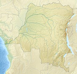
Relief location map of Democratic_Republic_of_the_Congo.
- Projection: Equirectangular projection, stretched by 100.0%.
- Geographic limits of the map:
- N: 6.0° N
- S: -14.0° N
- W: 11.0° E
- E: 32.0° E
- GMT projection: -JX19.473333333333333cd/18.546031746031744cd
- GMT region: -R11.0/-14.0/32.0/6.0r
- GMT region for grdcut: -R11.0/-14.0/32.0/6.0r
- Relief: SRTM30plus.
- Made with Natural Earth. Free vector and raster map data @ naturalearthdata.com.


