Udon Thani
| Udon Thani เทศบาลนครอุดรธานี | |
|---|---|
 | |
| Overblik | |
| Land | |
| Postnr. | 41000 |
| Demografi | |
| Indbyggere | 130.274 (2017)[1] |
| - Areal | 47,7 km² |
| - Befolkningstæthed | 2.731 pr. km² |
| Andet | |
| Hjemmeside | www.udoncity.go.th |
| Oversigtskort | |


Udon Thani er en by i det nordøstlige Thailand med 130.274 (2017)[1] indbyggere. Byen er hovedstad i en provins af samme navn og ligger cirka 60 kilometer syd for grænsen til nabolandet Laos.
Referencer
Eksterne henvisninger
| Spire |
Medier brugt på denne side
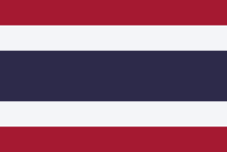
The national flag of Kingdom of Thailand; there are total of 3 colours:
- Red represents the blood spilt to protect Thailand’s independence and often more simply described as representing the nation.
- White represents the religion of Buddhism, the predominant religion of the nation
- Blue represents the monarchy of the nation, which is recognised as the centre of Thai hearts.
Forfatter/Opretter:
Flag map of Thailand
Forfatter/Opretter: NordNordWest, Licens: CC BY 3.0
Location map of Thailand
Forfatter/Opretter: Stefan Fussan, Licens: CC BY-SA 3.0
The City Pillar Shrine, Udon Thani, Thailand


