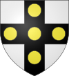
Tourcoing
| Tourcoing – fransk kommune (commune) – | |||||
|---|---|---|---|---|---|
| |||||
 Rådhuset i Tourcoing | |||||
| Land | |||||
| Region | |||||
| Departement | Nord | ||||
| Arrondissement | Lille (arrondissement) | ||||
| Kanton | hovedby for kantonerne: : Tourcoing-Nord Tourcoing-Nord-Est Tourcoing-Sud | ||||
| Interkommunal enhed | Lille Métropole Communauté urbaine | ||||
| Borgmester | Didier Droart (2017-2019) | ||||
| Geografi | |||||
| Koordinater | 50°43′23″N 03°09′40″Ø / 50.72306°N 3.16111°Ø | ||||
| Højde (gns) | 38 m | ||||
| Areal | 15,19 km² | ||||
| Demografi | |||||
| Indbyggere | 92.018 | ||||
| Befolkningstæthed | 6.058 indb./km² | ||||
| Postnummer | 59200 | ||||
| INSEE-kode | 59599 | ||||
| Hjemmeside | www.tourcoing.fr | ||||
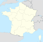
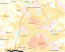 Kort over kommunen | |||||
Tourcoing (hollandsk: Toerkonje) er en kommune og by i det nordlige Frankrig, beliggende i departementet Nord tæt på den belgiske grænse. Den er hovedby for tre kantoner og danner sammen med Lille og Roubaix en bymæssig koncentration med ca. en mio. indbyggere. Tourcoing har selv 92.000 indbyggere (2005), der på fransk betegnes Tourquennois.
Demografi
| |||||||||||||||||||||||||||
| |||||||||||||||||||||||||||
| |||||||||||||||||||||||||||
| |||||||||||||||||||||||||||
Administration
Borgmestre
| Périodes | Identité | Parti | Qualité |
|---|---|---|---|
| 1790-1791 | Louis Desurmont | ||
| 1791-1792 | Pierre Motte-Florin | ||
| 1792-1795 | Louis Desurmont | ||
| 1795-1798 | Antoine Lehoucq | ||
| 1798 | Jean-Baptiste Wattel-Florin | ||
| 1798 | Antoine Lehoucq | ||
| 1798-1799 | Charles Delzenne | ||
| 1799-1800 | Philippe-François Suin | ||
| 1800 | Jean Wattine | ||
| 1800-1808 | Louis Desurmont fils | ||
| 1808-1816 | Pierre Delahaye | ||
| 1816-1822 | Fidèle Dewavrin-Frys | ||
| 1822-1830 | Laurent Destombes-Roussel | Monarchiste légitimiste | |
| 1830-1837 | Auguste Cordonnier | Conservateur catholique | |
| 1837-1847 | André Delahaye fils | Conservateur catholique | |
| 1847-1849 | Carlos Masurel | ||
| 1852-1853 | Louis Wattine | ||
| 1853-1855 | Carlos Masurel | ||
| 1857-1870 | Charles Roussel | ||
| 1870-1879 | André Delahaye | ||
| 1879-1881 | Désiré Debuchy | ||
| 1881-1899 | Victor Hassebroucq | ||
| 1899-1919 | Gustave Dron | Radical | |
| 1919-1925 | François Leduc | ||
| 1925-1930 | Gustave Dron | Radical | |
| 1930 | Jules Brassart | ||
| 1930-1935 | Albert Inghels | Socialiste | |
| 1935-1941 | Edmond Salembien | ||
| 1944-1947 | Fernand Lamblin | Maire à la Libération | |
| 1947-1959 | Louis Paris | Socialiste | |
| 1959-1977 | René Lecocq | Gaulliste | |
| 1977-1979 | Guy Chatiliez | Socialiste | |
| 1979-1983 | Maurice Devloo | Socialiste | |
| 1983-1989 | Stéphane Dermaux | Centriste | |
| 1989- 2008 | Jean-Pierre Balduyck | Socialiste | |
| 2008- | Michel François Delannoy | Socialiste | |

Venskabsbyer
Tourcoing har følgende venskabsbyer:
 Berlin Tyskland
 Biella, Italien
 Bottrop, Tyskland
 Guimarães, Portugal
 Jastrzębie-Zdrój, Polen
 Mouscron, Belgien
 Mühlhausen (Thüringen), Tyskland
 Rochdale, Forenede Kongerige
 Biskra, Algeriet
Referencer
- ^ Ibid.
Litteratur
- Philippe Waret & Jean-Pierre Popelier: Roubaix de A à Z. Editions Alain Sutton, Saint-Cyr-sur-Loire, 2006. ISBN 2-84910-459-0
- Michel David (m.fl.): Roubaix: cinquante ans de transformations urbaines et de mutations sociales. Presses Universitaires du Septentrion, Villeneuve d'Ascq, 2006, ISBN 2-85939-926-7
Se også
| Søsterprojekter med yderligere information: |
| Spire Denne artikel om Frankrigs geografi er en spire som bør udbygges. Du er velkommen til at hjælpe Wikipedia ved at udvide den. |
Medier brugt på denne side
Flag of Portugal, created by Columbano Bordalo Pinheiro (1857–1929), officially adopted by Portuguese government in June 30th 1911 (in use since about November 1910). Color shades matching the RGB values officially reccomended here. (PMS values should be used for direct ink or textile; CMYK for 4-color offset printing on paper; this is an image for screen display, RGB should be used.)
Map showing France with the ch flag.
Forfatter/Opretter: EALES, Licens: CC BY 2.5
Entrée de l'Hôtel de Ville de Tourcoing
Forfatter/Opretter: Germenfer, Licens: CC0
Flag of Hauts-de-France, one of the regions of France.
Forfatter/Opretter: EALES, Licens: CC BY 2.5
plan de Tourcoing et de ses quartiers
Forfatter/Opretter:
|
Map data (c) OpenStreetMap contributors, CC-BY-SA  • Shape files infrastructure: railway, highways, water: all originally by OpenStreetMap contributors. Status december 2011 *note: shown commune boundaries are from OSM dump May 2012; at that time about 90% complete |
Map commune FR insee code 59599.png
