Toulouse
| Toulouse – fransk kommune (commune) – | |||||
|---|---|---|---|---|---|
| |||||
 Rådhuset i Toulouse | |||||
| Land | |||||
| Region | |||||
| Departement | Haute-Garonne | ||||
| Arrondissement | Toulouse | ||||
| Kanton | Hovedby for 15 cantoner | ||||
| Interkommunal enhed | Communauté urbaine du Grand Toulouse | ||||
| Borgmester | Jean-Luc Moudenc (fra 2014) | ||||
| Geografi | |||||
| Koordinater | 43°36′16″N 1°26′38″Ø / 43.60444°N 1.44389°Ø | ||||
| Højde (gns) | 146 m | ||||
| Areal | 118,30 km² | ||||
| Demografi | |||||
| Indbyggere | 447.340 | ||||
| Befolkningstæthed | 3.781 indb./km² | ||||
| Postnummer | 31000, 31100, 31200, 31300, 31400, 31500 | ||||
| INSEE-kode | 31555 | ||||
| Hjemmeside | www.toulouse.fr | ||||
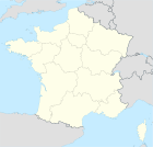
 Kort over kommunen | |||||
Toulouse er en by i Frankrig. Byen kaldes "la ville rose", som betyder "den lyserøde by", fordi mange af dens bygninger er bygget af brændte røde sten. Universitetet blev grundlagt i 1228.
Byen er hovedstaden i regionen Occitanie. Den er central for europæisk flyindustri, da flyfabrikken Airbus har hovedsæde her.
21. september 2001 eksploderede kemifabrikken AZF. Esplosionen blev målt til 3,4 på Richterskalaen.
Uddannelse
Toulouse har tre universiteter (Toulouse Capitole, Toulouse Jean Jaurès, Toulouse III Paul Sabatier) samlet inden for universitetet i Toulouse. Byen har også tre store luftfartsingeniørskoler (ENAC, IPSA, SUPAERO), generelle ingeniørskoler (EPITA, INPT, INSA), en datalogiskole (EPITECH), en økonomiskole (Toulouse School of Economics), en designskole (e-artsup), en kommunikationsskole (ISEG), tre store handelsskoler (TBS, TSM, ISG), en meteorologiskole, en veterinærskole og en statskundskab.
Fødsel i Toulouse
- Louis Aliot (1969-), fransk politiker
Eksterne henvisninger
Kilder
| Spire Denne artikel om Frankrigs geografi er en spire som bør udbygges. Du er velkommen til at hjælpe Wikipedia ved at udvide den. |
Medier brugt på denne side
Flag of Occitania
The Flag of Europe is the flag and emblem of the European Union (EU) and Council of Europe (CoE). It consists of a circle of 12 golden (yellow) stars on a blue background. It was created in 1955 by the CoE and adopted by the EU, then the European Communities, in the 1980s.
The CoE and EU are distinct in membership and nature. The CoE is a 47-member international organisation dealing with human rights and rule of law, while the EU is a quasi-federal union of 27 states focused on economic integration and political cooperation. Today, the flag is mostly associated with the latter.
It was the intention of the CoE that the flag should come to represent Europe as a whole, and since its adoption the membership of the CoE covers nearly the entire continent. This is why the EU adopted the same flag. The flag has been used to represent Europe in sporting events and as a pro-democracy banner outside the Union.Flag of Portugal, created by Columbano Bordalo Pinheiro (1857–1929), officially adopted by Portuguese government in June 30th 1911 (in use since about November 1910). Color shades matching the RGB values officially reccomended here. (PMS values should be used for direct ink or textile; CMYK for 4-color offset printing on paper; this is an image for screen display, RGB should be used.)
Flag of Austria with the red in the Austrian national colours which was official ordered within the Austrian Armed Forces (Bundesheer) in the characteristic “Pantone 032 C” (since May 2018 the Red is ordered in the characteristic “Pantone 186 C”.)
Finlands flag
Map showing France with the ch flag.
Map showing France with the ch flag.
Forfatter/Opretter: User:En-bateau (compilation), Licens: CC BY-SA 3.0
Images, De haut en bas et de gauche à droite :
- Pont Saint-Pierre de Toulouse : File:Pont_Saint-Pierre2.jpg par Aleske.
- Place du Capitole : File:Capitole_de_Toulouse_en_jardin_3.JPG par Gloumouth1.
- Pont-Neuf de Toulouse : File:Pont-Neuf_de_Toulouse.jpg par 4nitsirk [1]
- Capitole de Toulouse : File:Place_du_Capitole_Toulouse.jpg par chantrybee [2]
- Ariane 5, Cité de l’Espace : File:Ariane 5 at Cite de l'Espace 3.jpg par Mike Peel [www.mikepeel.net]
- Minimes File:Toulouse_Minimes.jpg par AlphaTangoBravo / Adam Baker [3].
Forfatter/Opretter:
|
Map data (c) OpenStreetMap contributors, CC-BY-SA  • Shape files infrastructure: railway, highways, water: all originally by OpenStreetMap contributors. Status december 2011 *note: shown commune boundaries are from OSM dump May 2012; at that time about 90% complete |
Map commune FR insee code 31555.png

