Sundbyøster
| Sundbyøster København | |
|---|---|
| Overblik | |
| Bydel: | Sundbyøster |
| Postnr.: | 2300 København S |
| Kommune: | Københavns Kommune |
| Indbyggertal kommune: | 659.350[1] (2024) |
| Indbyggertal bydel: | 48.476 (2003) |
| Sogn(e): | Filips-, Simon Peters-, Sundkirkens Sogne |
 | |
| Oversigtskort | |
Sundbyøster er en bydel i Amager Øst i København. Den er en del af Sundbyerne.
Sundbyøster var i 2002-2007 en administrativ bydel, som efterfølgende administrativt blev sammenlagt med Amagerbro under navnet Amager Øst.[kilde mangler]
Sundbyøster Plads ved Amagerbrogade er knudepunkt for legepladsen 'Hjørnet', Sundbyøster Hallen samt Sundbyøster skole.
Referencer
- ^ Danmarks Statistik: Statistikbanken Tabel BEF44

A: Indre By
B: Christianshavn
C: Indre Østerbro
D: Ydre Østerbro
E: Indre Nørrebro
F: Ydre Nørrebro
G: Bispebjerg
H: Vanløse
I: Brønshøj-Husum
J: Vesterbro
K: Kongens Enghave
L: Valby
M: Vestamager
N: Sundbyvester
O: Sundbyøster
Medier brugt på denne side
Forfatter/Opretter: OSM contributors, Licens: CC BY-SA 2.0
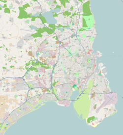
Map of Copenhagen with surroundings
Forfatter/Opretter: Erik Frohne, Licens: CC BY-SA 3.0
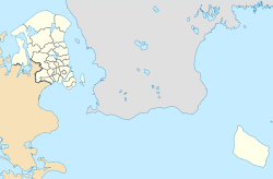
Location map of the Capital Region in Denmark, color adjusted
Equirectangular projection, N/S stretching 177 %. Geographic limits of the map:
- N: 56.20° N
- S: 54.90° N
- W: 11.70° E
- E: 15.20° E
Forfatter/Opretter: webjay from Denmark, Licens: CC BY 2.0
Filips Kirke on Amager in Copenhagen, Denmark
Forfatter/Opretter: Vectorised by Froztbyte, Licens: CC BY-SA 3.0
Districts of Copenhagen municipality (1 January 2002 — 31 December 2006) — the borders of the districts were based primarily on - Bydels kort (Københavns Kommune) and detailed maps of the surrounding municipalities. The 15 administrative, statistical and tax districts (bydele) are:
- A: Indre By ("Copenhagen Center")
- B: Christianshavn
- C: Indre Østerbro ("Inner Østerbro")
- D: Ydre Østerbro ("Outer Østerbro")
- E: Indre Nørrebro ("Inner Nørrebro")
- F: Ydre Nørrebro ("Outer Nørrebro")
- G: Bispebjerg
- H: Vanløse
- I: Brønshøj-Husum
- J: Vesterbro
- K: Kongens Enghave
- L: Valby
- M: Vestamager
- N: Sundbyvester
- O: Sundbyøster
The surrounding municipalities are:


