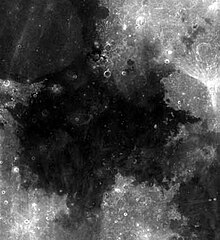
Stilhedens Hav

For romanen af samme navn, se Stilhedens Hav (roman)
| Stilhedens Hav (Mare Tranquillitatis) | |
|---|---|
 Stilhedens Hav | |
| Koordinater | 8°30′N 31°24′Ø / 8.5°N 31.4°ØKoordinater: 8°30′N 31°24′Ø / 8.5°N 31.4°Ø° , ° |
| Diameter | 873 km |
| Eponym | Mare Tranquillitatis |
Stilhedens Hav (latin: Mare Tranquillitatis) er et månehav på Månens forside, beliggende vest for Mare Fecunditatis med en diameter på 873 km.[1][2] Månehavets overflade består af basalt dannet i Øvre Imbrian-epoken. De omkringliggende bjerge menes at være fra Nedre Imbrian. Månehavet har uregelmæssige kanter uden en egentlig struktur.
Den første månelanding fandt sted i Stilhedens Hav, da Apollo 11's landingsfartøj, Eagle, landede i månehavet den 20. juli 1969.
Stilhedens Hav er lidt mere blåt end resten af Månens overflade og er således let at genkende. Den blålige farve skyldes mest sandsynligt en højere koncentration af metaller i basalten eller klipperne.[3]
Stilhedens Hav (Mare Tranquillitatis) blev navngivet i 1651 af astronomerne Francesco Grimaldi og Giovanni Battista Riccioli i disses månekort Almagestum novum.[4][5]
Landinger

I forbindelse med planlægningen af de første bemandede missioner blev Stilhedens Hav identificeret som et potentielt landingssted grundet den forholdsvis jævne overflade i området. USA opsendte derfor rumfartøjet Ranger 8, der optog og transmitterede 7.137 nærbilleder af månehavet, inden fartøjet med overlæg blev styrtet ned i Stilhedens Hav.
Den 11. september 1967 landede månefartøjet Surveyor 5 i Stilhedens Hav som det femte landingsfartøj i det ubemandede Surveyor-program.
Stilhedens Hav blev valgt som landingsstedet for den første bemandede månelandingsmission. Den 20. juli 1969, kl. 20:18 UTC foretog astronauterne Neil Armstrong og Buzz Aldrin en landing som planlagt med Apollo 11's månelandingsmodul, kaldet Eagle. Koordinaterne for landingen er 0,8° N, 23,5° Ø og blev af Armstrong navngivet Tranquility Base (Stilhedsbasen). Tre mindre månekratere nord for basen er har fået navnene Aldrin, Collins og Armstrong efter de tre besætningsmedlemmer på Apollo 11.
Galleri
- Kort over Stilhedens Hav, hvorpå landingsstederne for Apollo 11, Apollo 17, Apollo 16 og Surveyor 5 er indtegnet. De nærliggende månehave Mare Fecunditatis (sydøst), Mare Crisium (nordøst) Mare Serenitatis (nordvest) og Mare Nectaris (syd) ses af kortet
- Buzz Aldrin foran det amerikanske flag på Stilhedens Hav under Apollo 11-missionen i 1969.
- Kort over styrken af Månens tyngdefelt i Stilhedens Hav.
- Landingen på Stilhedens Hav i 1969
Noter
- ^ "Moon Mare/Maria". Gazetteer of Planetary Nomenclature. USGS Astrogeology. Hentet 2010-08-20.
- ^ "Mare Tranquillitatis". Nasa. Arkiveret fra originalen 24. juni 2017. Hentet 28. juli 2017.
- ^ "Color of the Moon, nasa.gov". Arkiveret fra originalen 24. juni 2017. Hentet 28. juli 2017.
- ^ Scientist of the Day - Giovanni Battista Riccioli. Kansas City, MO: Linda Hall Library. 2017.
- ^ "RICCIOLI, Giambattista. Almagestum Novum Astronomiam. Bologna: Heirs of V. Benatius, 1651". Sophia E Rare Books.
Eksterne henvisninger
| ||||||||||||||||||||||
Medier brugt på denne side
Buzz Aldrin salutes the U.S flag on the Moon (mission time: 110:10:33). His fingertips are visible on the far side of his faceplate. Note the well-defined footprints in the foreground. Buzz is facing up-Sun. There is a reflection of the Sun in his visor. At the bottom of Buzz's faceplate, note the white 'rim' which is slightly separated from his neckring. This 'rim' is the bottom of his gold visor, which he has pulled down. We can see the LEC straps hanging down inside of the ladder strut. In the foreground, we can see the foot-grabbing loops in the TV cable. The double crater under Neil's LM window is just beyond the LM shadow.
Photo from Apollo 11 mission to the moon. AS11-37-5437.
en:Mare Tranquillitatis sits within the Tranquillitatis basin. The mare material within the basin consists of basalt in the intermediate to young age group of the Upper Imbrian epoch. The surrounding mountains are thought to be of the Lower Imbrian epoch, but the actual basin is probably Pre-Nectarian. The basin has irregular margins and lacks
a defined multiple-ringed structure. The irregular topography in and near this basin results from the intersection of the Tranquillitatis, Nectaris, Crisium, Fecunditatis, and Serenitatis basins with two throughgoing rings of hypothetical Procellarum basin. Mare Serenitatis is seen in the upper left of the photo below. Palus Somni, on the northeastern rim of the mare, is filled with the basalt that spilled over from Tranquillitatis. This mare also served as the landing
site for Apollo 11, the first manned landing on the Moon.Apollo 11 - Landing on the Sea of Tranquility - July 20, 1969, 16mm landing film.
Mare Tranquillitatis gravity map (red=high, blue=low). Generated from GRAIL Colorized Gravity Anomalies (JPL) layer with LRO-WAC Shaded Relief at 30% opacity overlain.


