Shiga-præfekturet
| Shiga-præfekturet | |||||
|---|---|---|---|---|---|
| |||||
(c) 663highland, CC BY 2.5 | |||||
| Overblik | |||||
| Land | |||||
| Guvernør | Taizo Mikazuki | ||||
| Ø | Honshū | ||||
| Region | Kansai | ||||
| Hovedby | Ōtsu | ||||
| Demografi | |||||
| Indbyggere | 1.411.168 (2021)[1] | ||||
| - Areal | 4.017 km² | ||||
| - Befolkningstæthed | 351 pr. km² | ||||
| Andet | |||||
| Tidszone | UTC+9 japansk standardtid | ||||
| Hjemmeside | www.pref.shiga.lg.jp | ||||
| Oversigtskort | |||||
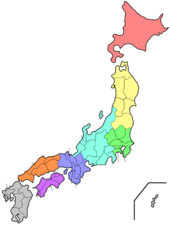
| Shiga-præfekturets beliggenhed i Japan. | |||||
Shiga-præfekturet (滋賀県 Shiga-ken) er et præfektur i Japan.
Præfekturet ligger i regionen Kansai på den centrale del af Japans hovedø Honshū. Det har et areal på 4.017 km2 og et befolkningstal på 1.411.168 (2021)[1] indbyggere. Hovedbyen er byen Ōtsu.
Referencer
- ^ a b 毎月人口推計調査|滋賀県ホームページ, hentet 25. marts 2021 (fra Wikidata).
Eksterne henvisninger
| Spire |
Medier brugt på denne side
Flag-map of Japan
Emblem of Shiga Prefecture, Japan. Light blue stylized Katakana character of Shiga. The emblem expresses Japan's largest lake The Biwako in light blue round shape and wings which represent harmony and progress. The symbol announced on May 3, 1957.
Flag of Shiga Prefecture, Japan.
White stylized Katakana character of Shiga on light blue field. The emblem expresses Japan's largest lake The Biwako in light blue round shape and wings which represent harmony and progress. Adopted 16 September 1968. The flag is based on the symbol announced on May 3, 1957.
(c) 663highland, CC BY 2.5
Mangetsu-ji in Otsu, Shiga prefecture, Japan
Blank map of Japanese Prefectures
Forfatter/Opretter: Lincun, Licens: CC BY-SA 3.0
Map of Japan with highlight on Shiga-ken


