Schwarzau am Steinfeld
| Schwarzau am Steinfeld | |||
|---|---|---|---|
| |||
(c) Steindy, CC BY-SA 3.0 | |||
| Overblik | |||
| Land | |||
| Postnr. | 2625 | ||
| Telefonkode | 02627 | ||
| Nummerpladebogstav(er) | NK | ||
| Demografi | |||
| Indbyggere | 1.924 (2018)[1] | ||
| Andet | |||
| Tidszone | UTC+1 (normaltid) UTC+2 (sommertid) | ||
| Højde m.o.h. | 329 m | ||
| Hjemmeside | www.schwarzau.at | ||
| Oversigtskort | |||
Schwarzau am Steinfeld er en by i delstaten Niederösterreich i det østlige Østrig, med et indbyggertal på 1.924(2018)[1] indbyggere.
Referencer
- ^ a b Einwohnerzahl 1.1.2018 nach Gemeinden mit Status, Gebietsstand 1.1.2018, Statistics Austria, hentet 9. marts 2019 (fra Wikidata).
Eksterne henvisninger
| Spire Denne artikel om østrigsk geografi er en spire som bør udbygges. Du er velkommen til at hjælpe Wikipedia ved at udvide den. |
|
Medier brugt på denne side
Flag of Austria with the red in the Austrian national colours which was official ordered within the Austrian Armed Forces (Bundesheer) in the characteristic “Pantone 032 C” (since May 2018 the Red is ordered in the characteristic “Pantone 186 C”.)
Flag-map of Austria
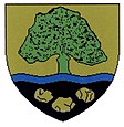
Coat of arms of Schwarzau am Steinfeld, Lower Austria
(c) Steindy, CC BY-SA 3.0
Schwarzau am Steinfelde mit dem Schneeberg
Forfatter/Opretter: Lencer, Licens: CC BY-SA 3.0
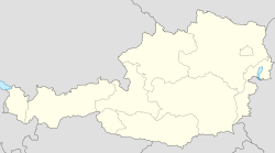
Location map of Austria
Equirectangular projection, N/S stretching 150 %. Geographic limits of the map:
- N: 49.2° N
- S: 46.3° N
- W: 9.4° E
- E: 17.2° E


