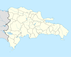
Santo Domingo
| Santo Domingo Santo Domingo de Guzmán | |||
|---|---|---|---|
| |||
 | |||
| Overblik | |||
| Land | |||
| Grundlagt | 1496 | ||
| Postnr. | 10100 | ||
| Telefonkode | 809, 829, 849 | ||
| Demografi | |||
| Indbyggere | 1.128.678 (2021) | ||
| - Areal | 1.302 km² | ||
| - Befolkningstæthed | 867 pr. km² | ||
| Andet | |||
| Tidszone | UTC-04:00 | ||
| Højde m.o.h. | 14 m | ||
| Hjemmeside | adn.gob.do | ||
| Oversigtskort | |||
Santo Domingo de Guzmán er Dominikanske Republiks hovedstad. Byen har 1.484.789(2010),1.128.678(2021)indbyggere og ligger ved det Caribiske Hav, ved mundingen af floden Ozama.
Historie
Byen blev grundlagt som Santo Domingo de Guzmán mellem 1496 og 1498, af Bartolomeo Columbus (Bartolomé Colón), bror af Christoffer Columbus. Den lå oprindeligt på den østlige bred af Ozama, men blev udvidet til at omfatte den vestlige bred i 1502.
I 1538 begyndte man opførelsen af det ældste universitet i "Den nye verden". Det fik navnet Santo Tomás de Aquino efter Sankt Thomas Aquinas, og eksisterer i dag som Universidad Autónoma de Santo Domingo (UASD). I 1990 blev byens koloniale bydel optaget på UNESCOs verdensarvsliste.
Referencer
|
Medier brugt på denne side
The flag of the Dominican Republic has a centered white cross that extends to the edges. This emblem is similar to the flag design and shows a bible, a cross of gold and 6 Dominican flags. There are branches of olive and palm around the shield and above on the ribbon is the motto "Dios,Patria!, Libertad" ("God, Country, Freedom") and to amiable freedom. The blue is said to stand for liberty, red for the fire and blood of the independence struggle and the white cross symbolized that God has not forgotten his people. "Republica Dominicana". The Dominican flag was designed by Juan Pablo Duarte, father of the national Independence of Dominican Republic. The first dominican flag was sewn by a young lady named Concepción Bona, who lived across the street of El Baluarte, monument where the patriots gathered to fight for the independence, the night of February 27th, 1844. Concepción Bona was helped by her first cousin María de Jesús Pina.
This is a picture atop Novocentro tower viewing the city to the southwest
Forfatter/Opretter: haitham alfalah, Licens: CC BY-SA 3.0
Plaza Espana
سانتو دومينغو
الدومنيكانForfatter/Opretter: Alexrk2, Licens: CC BY-SA 3.0
Location map Dominican Republic with Provinces, Equirectangular projection, N/S stretching 105 %. Geographic limits of the map:
Forfatter/Opretter:
Coat of arms of Santo Domingo (Dominican Republic)


