San Basilio
| San Basilio Santu 'Asìli 'e mònti | |
|---|---|
 | |
| Overblik | |
| Land | |
| Region | |
| Provins | Sud Sardegna |
| Postnr. | 09040 |
| Telefonkode | 070 |
| Nummerpladebogstav(er) | SU |
| Demografi | |
| Indbyggere | 1.238 (2016) |
| - Areal | 44,63 km² |
| - Befolkningstæthed | 27,73 pr. km² |
| Andet | |
| Tidszone | UTC+1 (normaltid) UTC+2 (sommertid) |
| Højde m.o.h. | 415 m |
| Hjemmeside | www.comune.sanbasilio.ca.it |
| Oversigtskort | |
San Basilio (sardisk: Santu 'Asìli 'e mònti) er en by og en kommune (comune) i provinsen Sud Sardegna i regionen Sardinien i Italien. Byen ligger i 415 meters højde og har 1.238 indbyggere (2016).[1] Kommunen har et areal på 44,63 km²[2] og grænser til kommunerne San Nicolò Gerrei, Sant'Andrea Frius, Senorbì, Silius og Siurgus Donigala.
Referencer
- ^ Istat - Istituto nazionale di statistica, Bilancio demografico al 30/11/2016. Hentet 24. april 2019
- ^ Istat - Istituto nazionale di statistica, Superficie territoriale per zona altimetrica. Hentet 24. april 2019
Henvisninger
| Spire |
Medier brugt på denne side
Forfatter/Opretter:
- Bandiera ufficiale RAS.jpg: icnussa / derivative work: Xander89
Flag of the Italian autonomous region Sardinia.
Forfatter/Opretter: TUBS
Location of province XY (see filename) in Italy.
Forfatter/Opretter: Angelus, Licens: CC BY-SA 3.0
Flag of the Italian autonomous region Sardinia.
Forfatter/Opretter: es:Usuario:Mnemoc, Licens: CC BY-SA 3.0
SVG of Italy merged with the flag
Forfatter/Opretter: Michael Gissing, Licens: CC BY-SA 3.0
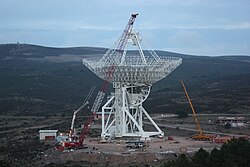
Picture of the Sardinia Radio Telescope (SRT) under construction. Picture taken at the official vista point of the construction site.


