Ross County
| Ross County, Ohio | |
 | |
| Kort | |
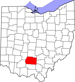
 Placering i delstaten Ohio | |
 Ohios placering i USA | |
| Basis data | |
| Grundlagt | 1798 |
|---|---|
| Hovedby | Chillicothe |
| Største by | Chillicothe |
| Areal - I alt - Land - Vand | 1795 km² 1783 km² 12 km² |
| Befolkningstal - år 2000 Befolkningstæthed | 73345 41 indb/km² |
| Hjemmeside: www.co.ross.oh.us | |
| Opkaldt efter: James Ross | |
| Historisk befolkningstal | |||
|---|---|---|---|
| Tælling | Bef.tal | %± | |
| 1800 | 8.540 | ||
| 1810 | 15.514 | 81.7% | |
| 1820 | 20.619 | 32.9% | |
| 1830 | 24.068 | 16.7% | |
| 1840 | 27.460 | 14.1% | |
| 1850 | 32.074 | 16.8% | |
| 1860 | 35.071 | 9.3% | |
| 1870 | 37.097 | 5.8% | |
| 1880 | 40.307 | 8.7% | |
| 1890 | 39.454 | -2.1% | |
| 1900 | 40.940 | 3.8% | |
| 1910 | 40.069 | -2.1% | |
| 1920 | 41.556 | 3.7% | |
| 1930 | 45.181 | 8.7% | |
| 1940 | 52.147 | 15.4% | |
| 1950 | 54.424 | 4.4% | |
| 1960 | 61.215 | 12.5% | |
| 1970 | 61.211 | -0,0% | |
| 1980 | 65.004 | 6.2% | |
| 1990 | 69.330 | 6.7% | |
| 2000 | 73.345 | 5.8% | |
Ross County er et county i den amerikanske delstat Ohio.
Eksterne henvisninger
Koordinater: 39°19′48″N 83°3′36″V / 39.33000°N 83.06000°V
|
Medier brugt på denne side
Map of USA OH.svg
Forfatter/Opretter: This version: uploader
Base versions this one is derived from: originally created by en:User:Wapcaplet, Licens: CC BY 2.0
Map of USA with Ohio highlighted
Forfatter/Opretter: This version: uploader
Base versions this one is derived from: originally created by en:User:Wapcaplet, Licens: CC BY 2.0
Map of USA with Ohio highlighted
Map of Ohio highlighting Ross County.svg
This is a locator map showing Ross County in Ohio. For more information, see Commons:United States county locator maps.
This is a locator map showing Ross County in Ohio. For more information, see Commons:United States county locator maps.


