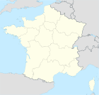
Rosny-sous-Bois
| Rosny-sous-Bois – fransk kommune (commune) – | |||||
|---|---|---|---|---|---|
| |||||
 Rådhuset i Rosny-sous-Bois | |||||
| Land | |||||
| Region | |||||
| Departement | Seine-Saint-Denis | ||||
| Arrondissement | Bobigny | ||||
| Interkommunal enhed | Association des collectivités territoriales de l'Est parisien | ||||
| Borgmester | Claude Capillon (fra 2014) | ||||
| Geografi | |||||
| Koordinater | 48°52′00″N 2°29′00″Ø / 48.86667°N 2.48333°ØKoordinater: 48°52′00″N 2°29′00″Ø / 48.86667°N 2.48333°Ø | ||||
| Højde (gns) | 69 m | ||||
| Areal | 5,91 km² | ||||
| Demografi | |||||
| Indbyggere | 41.254 | ||||
| Befolkningstæthed | 6.980 indb./km² | ||||
| Postnummer | 93110 | ||||
| INSEE-kode | 93064 | ||||
| Hjemmeside | www.rosny93.fr | ||||
 Kort over kommunen | |||||
Rosny-sous-Bois er en fransk kommune i departementet Seine-Saint-Denis i Paris' østlige forstæder.
Eksterne henvisninger
|
Medier brugt på denne side
Cultural flag for the region Île-de-France in France, based on the flag of the kingdom of France (s.XIV-XV). It is neither recognized nor used by public authorities of Île-de-France.
Cultural flag for the region Île-de-France in France, based on the flag of the kingdom of France (s.XIV-XV). It is neither recognized nor used by public authorities of Île-de-France.
Forfatter/Opretter:
|
Map data (c) OpenStreetMap contributors, CC-BY-SA  • Shape files infrastructure: railway, highways, water: all originally by OpenStreetMap contributors. Status december 2011 *note: shown commune boundaries are from OSM dump May 2012; at that time about 90% complete |
Map of French municipality Rosny-sous-Bois


