Rivas-Vaciamadrid
| Rivas-Vaciamadrid | |||||
|---|---|---|---|---|---|
| |||||
 | |||||
| Overblik | |||||
| Land | |||||
| Autonom region | |||||
| Provins | |||||
| Amt | Cuenca del Henares | ||||
| Borgmester | Pedro del Cura[1] | ||||
| Postnr. | 28521, 28522, 28523 y 28524 | ||||
| Nummerpladebogstav(er) | M | ||||
| Demografi | |||||
| Indbyggere | 101.949 (2024) | ||||
| - Areal | 67,0 km² | ||||
| - Befolkningstæthed | 1.522 pr. km² | ||||
| Andet | |||||
| Tidszone | UTC+1 | ||||
| Højde m.o.h. | 590 m | ||||
| Hjemmeside | www.rivasciudad.es | ||||
| Oversigtskort | |||||
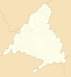
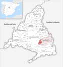
| Kommunens beliggenhed i Madrid-regionen | |||||
(c) Miguillen, CC BY-SA 3.0 Rivas-Vaciamadrid | |||||
Rivas-Vaciamadrid er en by og kommune i det centrale Spanien i Madrid-regionen. Den har et indbyggertal på 101.949 (2024) indbyggere.
Referencer
Eksterne henvisninger
| Spire |
Medier brugt på denne side
Forfatter/Opretter: See file history, Licens: CC0
Flag of the Community of Madrid (Spain)
Forfatter/Opretter: Roi González Villa (Vivaelcelta), Licens: CC BY-SA 3.0
Location map of Spain
Equirectangular projection, N/S stretching 130 %. Geographic limits of the map:
- N: 44.4° N
- S: 34.7° N
- W: 9.9° W
- E: 4.8° E
Forfatter/Opretter: jynus, Licens: CC BY-SA 3.0
Silhouette of Spain with Spanish Flag.
Forfatter/Opretter: SanchoPanzaXXI, Licens: CC BY-SA 4.0
Representación del escudo de Rivas-Vaciamadrid (Madrid), según el blasón: De gules, una pira de plata, renversada, cargada en jefe de un bezante de lo mismo, brochante de una estrella de ocho puntas, de gules. Al timbre, corona real cerrada. adaptado del descrito en Rivas estrena símbolos municipales, revista Este de Madrid
Bandera de Rivas-Vaciamadrid, en Madrid (España)
Forfatter/Opretter: Tschubby, Licens: CC BY-SA 3.0
Gemeinde Rivas-Vaciamadrid
Forfatter/Opretter: Zarateman, Licens: CC0
Ayuntamiento de Rivas-Vaciamadrid


