Richland County (South Carolina)
 For alternative betydninger, se Richland County. (Se også artikler, som begynder med Richland County)
Koordinater: 34°02′N 80°54′V / 34.033°N 80.900°V
| Richland County, South Carolina | |
| Kort | |
 Placering i delstaten South Carolina | |
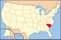
 South Carolinas placering i USA | |
| Basis data | |
| Grundlagt | 1785 |
|---|---|
| Hovedby | Columbia, South Carolina |
| Areal - I alt - Land - Vand | 1999 km² 1961 km² 37,9 km² |
| Befolkningstal - år 2010 Befolkningstæthed | 384504 192,3 indb/km² |
| [1][2] | |
Richland County er et county i delstaten South Carolina, USA, med 384 504 indbyggere. Administrationscentrum (county seat) er Columbia, der også er delstatshovedstad.
I countyet ligger Congaree National Park.
Nabocounties
- Fairfield County, South Carolina - nord
- Kershaw County, South Carolina - nordøst
- Sumter County, South Carolina - øst
- Calhoun County, South Carolina - syd
- Lexington County, South Carolina - vest
- Newberry County, South Carolina - nordvest
Kilder
- ^ "State & County QuickFacts, Richland County, South Carolina" (engelsk). U.S. Census Bureau. Arkiveret fra originalen 17. juli 2011. Hentet 6. juli 2011.
- ^ "2010 Census U.S. Gazetteer Files for Counties". U.S. Census Bureau. Arkiveret fra originalen 5. juli 2012. Hentet 5. juli 2012.
| Spire |
|
Medier brugt på denne side
(c) Lokal_Profil, CC BY-SA 2.5
Map showing Mainland USA ("lower 48") with a superimposed US flag.
This is a locator map showing Richland County in South Carolina. For more information, see Commons:United States county locator maps.
Forfatter/Opretter: This version: uploader
Base versions this one is derived from: originally created by en:User:Wapcaplet, Licens: CC BY 2.0
Map of USA with South Carolina highlighted


