Republican River
| Republican River | |
| River | |
Bro over Republican i nærheden af Riverton | |
| Land | |
|---|---|
| Delstater | Kansas, Nebraska |
| Bifloder | |
| - venstre | North Fork Republican River |
| - højre | Arikaree River |
| Udspring | |
| - sted | Dundy County, Nebraska |
| - koord. | 40°01′12″N 101°56′16″V / 40.02000°N 101.93778°V [1] |
| Udmunding | Kansas River |
| - sted | Jefferson Township / Smoky Hill Township, Geary County, Kansas |
| - koord. | 39°3′36″N 96°48′5″V / 39.06000°N 96.80139°V [1] |
| Længde | 729 km |
| Afvandingsomr. | 64.491 km²[2] |
| Vandføring | |
| - middel | 24 m³/s[2] |
| - minimum | 0 m³/s |
Republican River er en 729 km lang flod der løber i den centrale del af Great Plains Nordamerika, med udspring i High Plains i det østlige Colorado. Den løber mod øst gennem Nebraska og Kansas. Floden har navn efter en stamme af Pawneeindianerne kendt som "the Republicans."[3]
Geografi
Republican River dannes ved sammenløbet af North Fork Republican River og Arikaree River lige nord for Haigler i Dundy County. Den møder South Fork Republican River umiddelbart syd for Benkelman. Alle tre tilløb har udspring i High Plains i det nordøstlige Colorado.[4][5][6] Fra sammenløbet løber floden hovedsagelig mod øst langs Nebraskas sydlige grænse, gennem Swanson Reservoir og Harlan County Reservoir før den drejer mod syd ind i Smoky Hills-regionen i Kansas. The Republican River løber ud i Smoky Hill River ved Junction City og danner her Kansas River. Nogle byer langs Republican River er: McCook, Clay Center, Concordia og Junction City. I nærheden af Concordia ligger Republican River Pegram Truss, en bro over Republican River som er på listen National Register of Historic Places.
Se også
Eksterne kilder/henvisninger
- ^ a b "Republican River". en:Geographic Names Information System, U.S. Geological Survey.
- ^ a b "USGS Gage #06857100 on the Republican River at Junction City, KS" (PDF). National Water Information System. U.S. Geological Survey. 1964-2014. Hentet 2014-01-21.
- ^ Stewart, George R. (1967) Names on the Land. Boston: Houghton Mifflin Company. p. 223.
- ^ "North Fork Republican River". en:Geographic Names Information System, U.S. Geological Survey.
- ^ "South Fork Republican River". en:Geographic Names Information System, U.S. Geological Survey.
- ^ "Arikaree River". en:Geographic Names Information System, U.S. Geological Survey.
|
Medier brugt på denne side
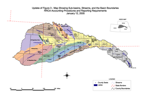
Map of the Republican River Basin in Colorado, Kansas, and Nebraska
North span of bridge over the Republican River, located near the intersection of county roads 43 and EF in Franklin County, Nebraska, southeast of Riverton. The 3-span pin-jointed Pratt through truss bridge was constructed in 1911 by the Empire Bridge Company of Falls City, Nebraska. It is listed in the National Register of Historic Places. The bridge no longer carries vehicular traffic; county road 43 now crosses the river on a concrete bridge just west (upstream). In the photo, the bridge is viewed from the west (upstream).


