Pontypool
| Pontypool | |
|---|---|
(c) Kev Griffin, CC BY-SA 2.0 | |
| Overblik | |
| Land | |
| Postnr. | NP4 |
| Telefonkode | 01495 |
| UN/LOCODE | GBPTP |
| Andet | |
| Hjemmeside | pontypoolcc.gov.uk |
| Oversigtskort | |
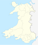
Pontypool (walisisk: Pont-y-pŵl eller Pont-Y-Pwll[1]) er en by og administrationscenter county boroughet Torfaen. Den ligger i det historiske county Monmouthshire i South Wales.[2][3] Byen havde indbyggertal på 28.970 personer i 2011, hvilket gør den til en af Wales' største byer.
Blandt byens attraktioner er Pontypool Park og Torfaen Museum.
Venskabsbyer
 Condeixa, Portugal siden 1994
 Bretten, Tyskland siden 1994
 Longjumeau, Frankrig siden 1994
Referencer
- ^ "How Welsh cities and towns got their names". Wales Online. 6. januar 2019. Hentet 28. april 2021.
- ^ "Cwm Lickey, Pontypool:: OS grid ST2698 at Geograph". Geograph.org.uk. Hentet 15. juli 2013.
- ^ "Cwm Lickey, Pontypool:: OS grid ST2698 at Geograph". Geograph.org.uk. Hentet 15. juli 2013.
Eksterne henvisninger
| Spire |
Medier brugt på denne side
Flag of Portugal, created by Columbano Bordalo Pinheiro (1857–1929), officially adopted by Portuguese government in June 30th 1911 (in use since about November 1910). Color shades matching the RGB values officially reccomended here. (PMS values should be used for direct ink or textile; CMYK for 4-color offset printing on paper; this is an image for screen display, RGB should be used.)
Forfatter/Opretter: NordNordWest, Licens: CC BY-SA 3.0
Location map of Wales, United Kingdom
(c) Kev Griffin, CC BY-SA 2.0
Crane Street, Pontypool A redeveloped Crane Street (one of the principal shopping streets) and new shop units. Photograph taken from the North Eastern end of the street, facing South West.
Forfatter/Opretter:
- Wales_location_map.svg: NordNordWest
- Flag_of_Wales_2.svg:
- derivative work: Fry1989 eh? 20:04, 8 December 2011 (UTC)
Flag map of Wales


