Ponteilla
| Ponteilla – fransk kommune (commune) – | |||||
|---|---|---|---|---|---|
| |||||
 | |||||
| Land | |||||
| Region | |||||
| Departement | Pyrénées-Orientales | ||||
| Arrondissement | Perpignan | ||||
| Kanton | Les Aspres | ||||
| Interkommunal enhed | Perpignan Méditerranée Métropole | ||||
| Borgmester | Rolland Thubert (fra 2014) | ||||
| Geografi | |||||
| Koordinater | 42°37′38″N 02°48′55″Ø / 42.62722°N 2.81528°ØKoordinater: 42°37′38″N 02°48′55″Ø / 42.62722°N 2.81528°Ø | ||||
| Højde (gns) | 101 m | ||||
| Areal | 13,78 km² | ||||
| Demografi | |||||
| Indbyggere | 2.793 | ||||
| Befolkningstæthed | 203 indb./km² | ||||
| Postnummer | 66300 | ||||
| INSEE-kode | 66145 | ||||
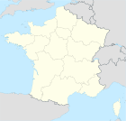
 Kort over kommunen | |||||
Ponteilla (på Catalansk: Pontellà) er en by og kommune i departementet Pyrénées-Orientales i Sydfrankrig.
Geografi
Ponteilla ligger på Roussillon-sletten 12 km sydvest for Perpignan centrum. Nærmeste byer er mod vest Thuir (7 km), mod nord Canohès (4 km), mod øst Pollestres og mod syd Trouillas (2 km).
Demografi
Udvikling i folketal
| |||||||||||||||||||||||||||
Kilder
Eksterne henvisninger
- Les Pyrénées Catalanes (fransk)
|
Medier brugt på denne side
Flag of Occitania
Forfatter/Opretter: WikiMeGa****, Licens: CC BY-SA 3.0
Arms of Pyrénées-Orientale department: Or, four pallets gules
Forfatter/Opretter:
|
Map data (c) OpenStreetMap contributors, CC-BY-SA • Shape files infrastructure: railway, highways, water: all originally by OpenStreetMap contributors. Status december 2011 *note: shown commune boundaries are from OSM dump May 2012; at that time about 90% complete |
Map of French municipality
Forfatter/Opretter: Chatsam, Licens: CC BY-SA 3.0
blason de la commune de Ponteilla : D’or à l’église du lieu flanquée de deux tours, soudée d’argent et maçonnée de sable, au chef d’or chargé de quatre pals de gueules.
Forfatter/Opretter: Adrille, Licens: CC BY-SA 3.0
The village of Ponteilla, in the south of France


