Peak District
| Peak District National Park | |
 Udsigt over Mam Tor, Peak District National Park | |
| Land | England |
|---|---|
| Counties | Derbyshire, Cheshire, Greater Manchester, Staffordshire, South Yorkshire, West Yorkshire |
| Areal | 1.440 km² |
| Oprettet | 17. april 1951 |
| Antal besøgende | 22 millioner[1] |
| IUCN-kategorier | V – Beskyttet landskab/havområde |
 Contains Ordnance Survey data © Crown copyright and database right, CC BY-SA 3.0 Peak District National Park (markeret med grøn) i England | |
| Hjemmeside: Officielt websted | |
Peak District er et højlandsområde i det centrale og nordlige England, øst for Manchester. Det meste ligger i Derbyshire, men også indenfor Cheshire, Staffordshire samt South og West Yorkshire. Det meste af området er inkluderet i Peak District nationalpark, som var den første nationalparken i Storbritannien. Parkgrænserne blev trukket sådan at man undgik at få byer med, men Buxton er praktisk talt omringet af parken.
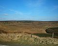
Området inddeles gerne i den nordlige del Dark Peak, hvor man finder mget moselandskab, og den sydlige White Peak som er det mest befolkede område. Ifølge parkmyndighederne er Peak District verdens næst mest populære nationalpark.
White Peak er et kalkstensområde, hvilket medfører at der er mange grotter. Under Dark Peak finder man skifer og sandsten. Det højeste punkt er toppen på Kinder Scout.
Galleri
 Burbage Rocks
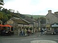 Castleton
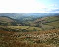 Dale Bottom - Hathersage
 Dunford Bridge
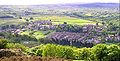 Hepworth
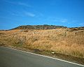 Higger Tor
 Holmfirth
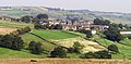 Holme, West Yorkshire
 Holme Moss Radio Tower
 Scholes
 The Rising Sun
 Toad's Mouth
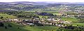 Totties
 Upper Holme Valley

Eksterne kilder og henvisninger
- ^ Holloway, J. Christopher (2006). The Business of Tourism (7th udgave). Harlow: Financial Times Prentice Hall. s. 149. ISBN 978-0-273-70161-3. Hentet 18. december 2015.
- Parkens officielle websted Arkiveret 13. oktober 2016 hos Wayback Machine
Artiklen bygger helt eller delvist på norsk og Engelsk Wikipedia.
| England |
| |
|---|---|---|
| Nordirland |
| |
| Skotland |
| |
| Wales |
| |
Se også Area of Outstanding Natural Beauty Året for oprettelsen som National Park er i parentes. Et område med ‡ har lignende status som en britisk National Park. Området markeret med † er foreslåede nationalparker. | ||
Medier brugt på denne side
.svg)
Contains Ordnance Survey data © Crown copyright and database right, CC BY-SA 3.0
Map of the Peak District National Park, UK with the following information shown:
- National Park boundary
- Administrative borders
- Coastline, lakes and rivers
- Roads and railways
- Urban areas
Equirectangular map projection on WGS 84 datum, with N/S stretched 165%
Geographic limits:
- West: 2.30W
- East: 1.50W
- North: 53.62N
- South: 53.00N
.JPG)
Forfatter/Opretter: Richard Harvey, Licens: CC BY-SA 2.0 uk
View of Holmfirth from Cliffs above Cliff Road, view is taken facing southwest. The A6024 (Woodhead Road) goes from the centre of the village to the top left of the photo

Forfatter/Opretter: Gregory Deryckère, Licens: CC BY 2.5
Higger Tor, Sheffield.
.jpg)
Forfatter/Opretter: Richard Harvey, Licens: CC BY-SA 3.0
Dunford Bridge South Yorkshire, In the centre can be seen the old sealed up entrances to the Woodhead rail tunnels. The road to the left is called Windle Edge and leads to the A628 Sheffield to Manchester Road.

Forfatter/Opretter: Gregory Deryckère, Licens: CC BY 2.5
Toad's Mouth, Hathersage/Sheffield.

Forfatter/Opretter: Gregory Deryckère, Licens: CC BY 2.5
Burbage edge, Sheffield.

Forfatter/Opretter: Gregory Deryckère, Licens: CC BY 2.5
The Rising Sun, Bamford, in the Peak District.

Forfatter/Opretter: Gregory Deryckère, Licens: CC BY 2.5
Dale Bottom and Hathersage, Peak District.

Forfatter/Opretter: Richard Harvey, Licens: CC BY-SA 2.5
View of Holme Village from Rake Head Road
.JPG)
Forfatter/Opretter: Richard Harvey, Licens: CC BY-SA 3.0
View of Scholes, Holmfirth, Kirklees from Tenter Hill

Forfatter/Opretter: Richard Harvey, Licens: CC BY-SA 3.0
View of The upper Holme Valley, West Yorkshire, england
.JPG)
Forfatter/Opretter: Richard Harvey, Licens: CC BY-SA 3.0
View of Totties, near Holmfirth, from Tenter Hill
Forfatter/Opretter: Evilbish, Licens: CC BY 3.0
Mam Tor with Winnat's Pass in the distance taken from the ridge path between Mam Tor and Hollin's Cross
.JPG)
Forfatter/Opretter: Richard Harvey, Licens: CC BY-SA 3.0
View of Hepworth, West Yorkshire, from Tenter Hill
Forfatter/Opretter: Richard Harvey, Licens: CC BY-SA 2.5
View of Holme Moss Radio Transmission Tower, from Kiln Bent Road.
