Pauillac
| Pauillac – fransk kommune (commune) – | |||
|---|---|---|---|
| |||
 Rådhuset i Pauillac | |||
| Land | |||
| Region | |||
| Departement | Gironde | ||
| Arrondissement | Arrondissement de Lesparre-Médoc | ||
| Kanton | Canton de Pauillac | ||
| Interkommunal enhed | Communauté de communes du Centre Médoc | ||
| Geografi | |||
| Koordinater | 45°11′59.79″N 0°44′55.63″V / 45.1999417°N 0.7487861°VKoordinater: 45°11′59.79″N 0°44′55.63″V / 45.1999417°N 0.7487861°V | ||
| Højde (gns) | 4 m | ||
| Areal | 22,74 km² | ||
| Demografi | |||
| Indbyggere | 5.059 | ||
| Befolkningstæthed | 222 indb./km² | ||
| Postnummer | 33250 | ||
| INSEE-kode | 33314 | ||
| Hjemmeside | www.pauillac-medoc.com | ||
 Kort over kommunen | |||
Pauillac er en commune i Gironde départementet i det sydvestlige Frankrig.
Under Tour de France 2010, var Pauillac målby for den 52 km lange 19. etape (enkeltstart) med start i Bordeaux.
Vin
Communen består af kun 3000 hektar (12 km²) vingårde i Haut-Médoc mellem landsbyerne Saint-Julien i syd og Saint-Estèphe i nord, men er også hjem for tre af Bordeaux' fem Premier Cru-vine: Château Lafite Rothschild, Château Latour og Château Mouton Rothschild.
Udvalg af Pauillac-landejendomme
- Château d'Armailhac
- Château Clerc-Milon
- Château Duhart-Milon-Rothschild
- Château Grand-Puy-Ducasse
- Château Grand-Puy-Lacoste
- Château Haut-Bages-Liberal
- Château Haut-Batailley
- Château Lafite Rothschild
- Château Latour
- Château Lynch-Bages
- Château Mouton Rothschild
- Château Pedesclaux
- Château Pichon Longueville Baron
- Château Pichon Longueville Comtesse de Lalande
- Château Pontet-Canet
Se også
- Fransk vin
- Bordeaux (vindistrikt)
Referencer
| Spire Denne artikel om Frankrigs geografi er en spire som bør udbygges. Du er velkommen til at hjælpe Wikipedia ved at udvide den. |
|
Medier brugt på denne side
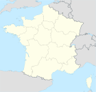
Map showing France with the ch flag.
Forfatter/Opretter:
|
Map data (c) OpenStreetMap contributors, CC-BY-SA  • Shape files infrastructure: railway, highways, water: all originally by OpenStreetMap contributors. Status december 2011 *note: shown commune boundaries are from OSM dump May 2012; at that time about 90% complete |
Map commune FR insee code 33314.png
Forfatter/Opretter: Patricia Fidi, Licens: CC0
Regional flag of the french province Aquitaine
Forfatter/Opretter: Louistisserand, Licens: CC BY-SA 3.0
Mairie de Pauillac (Gironde, France) vue de face


