Oms (Pyrénées-Orientales)
| Oms – fransk kommune (commune) – | |||||
|---|---|---|---|---|---|
| |||||
 | |||||
| Land | |||||
| Region | |||||
| Departement | Pyrénées-Orientales | ||||
| Arrondissement | Céret | ||||
| Kanton | Les Aspres | ||||
| Interkommunal enhed | Communauté de communes des Aspres | ||||
| Borgmester | Christian Vila (fra 2008) | ||||
| Geografi | |||||
| Koordinater | 42°32′42″N 02°41′49″Ø / 42.54500°N 2.69694°ØKoordinater: 42°32′42″N 02°41′49″Ø / 42.54500°N 2.69694°Ø | ||||
| Højde (gns) | 528 m | ||||
| Areal | 18,53 km² | ||||
| Demografi | |||||
| Indbyggere | 311 | ||||
| Befolkningstæthed | 17 indb./km² | ||||
| Postnummer | 66400 | ||||
| INSEE-kode | 66126 | ||||
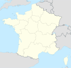
 Kort over kommunen | |||||
Oms er en by og kommune i departementet Pyrénées-Orientales i Sydfrankrig.
Geografi
Oms ligger 32 km sydvest for Perpignan. Nærmeste byer er mod sydvest Taillet (4 km), mod nordvest Calmeilles (4 km) og mod øst Llauro (6 km).
Demografi
Udvikling i folketal
| |||||||||||||||||||||||||||
Kilder
Eksterne henvisninger
|
Medier brugt på denne side
Flag of Occitania
Forfatter/Opretter: WikiMeGa****, Licens: CC BY-SA 3.0
Arms of Pyrénées-Orientale department: Or, four pallets gules
Forfatter/Opretter: Chatsam, Licens: CC BY-SA 3.0
Blason de la commune de Oms : D’argent aux trois ormes arrachés au naturel.
Forfatter/Opretter:
|
Map data (c) OpenStreetMap contributors, CC-BY-SA • Shape files infrastructure: railway, highways, water: all originally by OpenStreetMap contributors. Status december 2011 *note: shown commune boundaries are from OSM dump May 2012; at that time about 90% complete |
Map of French municipality
Forfatter/Opretter: LeZibou, Licens: CC-BY-SA-3.0
This building is inscrit au titre des monuments historiques de la France. It is indexed in the base Mérimée, a database of architectural heritage maintained by the French Ministry of Culture, under the reference PA00104060


