Matsumoto
| Matsumoto 松本市 | |||||
|---|---|---|---|---|---|
| |||||
 | |||||
| Overblik | |||||
| Land | |||||
| Borgmester | Yoshinao Gaun | ||||
| Ø | Honshū | ||||
| Region | Chūbu | ||||
| Præfektur | Nagano | ||||
| Grundlagt | 1. april 1889 | ||||
| Demografi | |||||
| Indbyggere | 239.115 (2021)[1] | ||||
| - Areal | 979 km² | ||||
| - Befolkningstæthed | 244 pr. km² | ||||
| Andet | |||||
| Tidszone | UTC+9 | ||||
| Hjemmeside | www.city.matsumoto.nagano.jp | ||||
| Oversigtskort | |||||
Matsumoto(松本市; -shi) er en by beliggende på øen Honshū i Japan. Byen har 239.115 (2021)[1] indbyggere.
Referencer
- ^ a b 毎月人口異動調査/長野県, hentet 31. marts 2021 (fra Wikidata).
Ekstern henvisning
- Matsumoto rådhus (japansk)
| Spire |
|
Medier brugt på denne side
Flag of Matsumoto, Nagano
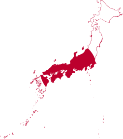
Flag-map of Japan
Forfatter/Opretter: Maximilian Dörrbecker (Chumwa), Licens: CC BY-SA 3.0
Location map of Japan
Equirectangular projection.
Geographic limits to locate objects in the main map with the main islands:
- N: 45°51'37" N (45.86°N)
- S: 30°01'13" N (30.02°N)
- W: 128°14'24" E (128.24°E)
- E: 149°16'13" E (149.27°E)
Geographic limits to locate objects in the side map with the Ryukyu Islands:
- N: 39°32'25" N (39.54°N)
- S: 23°42'36" N (23.71°N)
- W: 110°25'49" E (110.43°E)
- E: 131°26'25" E (131.44°E)
The symbol of Matsumoto city, Nagano prefecture (announced on January 8, 1938).
Forfatter/Opretter: 663highland, Licens: CC BY 2.5
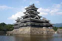
Matsumoto Castle in Matsumoto, Nagano prefecture, Japan.


