Maramureș-bjergene Naturpark
| Maramureș-bjergene Naturpark | |
|---|---|
| Parcul Natural Munții Maramureșului | |
IUCN kategori V (beskyttet landskab/hav) | |
 Maramureș-bjergene | |
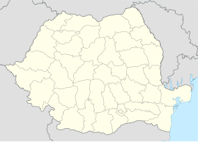
| Beliggenhed i Rumænien | |
| Sted | |
| Nærmeste by | Sighetu Marmației |
| Koordinater | 47°46′59″N 24°33′50″Ø / 47.783°N 24.564°ØKoordinater: 47°46′59″N 24°33′50″Ø / 47.783°N 24.564°Ø[1] |
| Areal | 1.488,50 km² |
| Etableret | 2005 |
| www.muntiimaramuresului.ro | |
Maramureș-bjergene Naturpark (rumænsk: Parcul Natural Munții Maramureșului) er et beskyttet område ( naturpark kategori V IUCN ) beliggende i Rumænien, i den nordlige del af distriktet Maramureș.[2]
Se også
Referencer
- ^ eunis.eea.europa.eu - Munţii Maramureşului Natural Park (coords); hentet 13. juni 2012
- ^ protectedplanet.net - Munţii Maramureşului Natural Park (location) (Webside ikke længere tilgængelig); hentet 13. juni 2012
Medier brugt på denne side
Forfatter/Opretter: NordNordWest, Licens: CC BY-SA 3.0
Location map of Romania
Massif of Pop Ivan in Maramureş Mountains. View from east from Farcău Massif.
Coat of arms of Maramureș County, Romania. "Officially adopted in 1998, the coat of arms of Maramureș has the shape of a cut shield, with the wisent head as an ancient local symbol of the legendary founders of Maramures, Dragoş and Bogdan. The Carpathian Chamonix and the firs trees symbolize the natural resources of the area, while the mining gauge symbolizes the importance of the mining sector in the area. Centrally positioned, the wooden church comes to prove that our county has the largest number of wooden churches in the country."


