Mamonovo
| Mamonovo | |||
|---|---|---|---|
| |||
| Overblik | |||
| Land | |||
| Føderalt distrikt | Nordvestlige | ||
| Oblast | |||
| Grundlagt | 1301 | ||
| Postnr. | 142715 | ||
| Telefonkode | 40156 | ||
| UN/LOCODE | RURZD | ||
| Demografi | |||
| Indbyggere | 8.295 (2023)[1] | ||
| - Areal | 20,9 km² | ||
| - Befolkningstæthed | 398 pr. km² | ||
| Andet | |||
| Tidszone | UTC+2 | ||
| Højde m.o.h. | 15 m | ||
| Hjemmeside | mamonovo.gov39.ru | ||
| Oversigtskort | |||
| Kaliningrad oblasts beliggenhed i Rusland | |||
(c) Karte: NordNordWest, Lizenz: Creative Commons by-sa-3.0 de Mamonovo | |||
Mamonovo (russisk: Мамоново; tr. Mamónovo), indtil 1946 kendt som Heiligenbeil (tysk: Heiligenbeil; polsk: Świętomiejsce eller Święta Siekierka; litauisk: Šventapilė), er en by i Rusland. Byen ligger i Kaliningrad oblast, der er en russisk eksklave mellem Polen og Litauen.
Mamonovo ligger tæt ved strandsøen Wisłabugten (tysk: Frisches Haff), ca. 50 kilometer sydvest for byen Kaliningrad og tæt på grænsen til Polen. Byen har et indbyggertal på 8.295 (2023)[1] indbyggere. Den blev grundlagt i 1301 ![]() under navnet Heiligenstadt.
under navnet Heiligenstadt.
Referencer
- ^ a b Численность постоянного населения Российской Федерации по муниципальным образованиям на 1 января 2023 года (с учётом итогов Всероссийской переписи населения 2020 г.), Federal State Statistics Service, hentet 23. august 2023 (fra Wikidata).
Eksterne henvisninger
| Spire |
Medier brugt på denne side
(c) RIA Novosti archive, image #942200 / Igor Zarembo / CC-BY-SA 3.0
“Border guards of the Federal Security Service pursuing trespassers of the maritime boundary during exercises in Kaliningrad region”. Military drill near Mamonovo border-crossing point in Kaliningrad region. Border guards of the Federal Security Service arresting a boat with fictitious trespassers of the the maritime boundary. Background: coast guard motorboat.
Flag-map of Russia
Forfatter/Opretter: Stasyan117, Licens: CC BY-SA 4.0
Калининградская область на карте России
Forfatter/Opretter: NordNordWest, Licens: CC BY-SA 3.0
Location map of the Kaliningrad Oblast, Russia
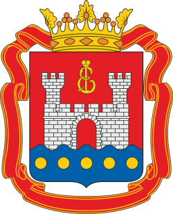
Coat of arms of Mamonovo (Kaliningrad oblast)
(c) Karte: NordNordWest, Lizenz: Creative Commons by-sa-3.0 de
Location map of European Russia.
- Projection: Lambert azimuthal equal-area projection.
- Area of interest:
- N: 75.0° N
- S: 40.0° N
- W: 25.0° E
- E: 60.0° E
- Projection center:
- NS: 57.5° N
- WE: 42.5° E
- GMT projection: -JA42.5/57.5/20c
- GMT region: -R25.450860698632475/38.37411418933942/86.79037939442836/70.79910933370674r
- GMT region for grdcut: -R-2.0/38.0/87.0/76.0r
- Made with Natural Earth. Free vector and raster map data @ naturalearthdata.com.
Coat of arms of the Kaliningrad region


