M1 (metro)
 For alternative betydninger, se M1. (Se også artikler, som begynder med M1)
| M1 | |
|---|---|
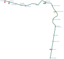
 Kort over M1 | |
| Overblik | |
| Type | Metro |
| System | Københavns Metro |
| Lokalitet | Storkøbenhavn |
| Endestationer | Vanløse Vestamager |
| Antal stationer | 15 |
| Drift | |
| Åbnet | 2002 |
| Ejer(e) | Københavns Metro |
| Operatør(er) | Metro Service A/S |
| Rullende materiel | Metrotog |
| Teknisk | |
| Antal spor | 2 |
| Sporvidde | 1.435 mm |
| Elektrificering | Ja |
| Strækningshastighed | 80 km/t |
M1 er én af de fire linjer som udgør den københavnske metro. Linjen tager sit udgangspunkt i Vanløse Station sammen med M2 som den følges med hele vejen til Christianshavn Station, hvorfra de kører til hhv. Vestamager Station og Lufthavnen Station.
M1 har følgende ruteplan, taget i rækkefølgen fra Vanløse Station:
|  Syd for DR Byen Station |
Koordinater: 55°40′08″N 12°35′35″Ø / 55.6688°N 12.593°Ø
Medier brugt på denne side
S-tog logo
Forfatter/Opretter: Artemco, Licens: CC BY-SA 4.0
syd for DR Byen Station
underground tunnel stop
Railway track icon. For use in Route diagram template (see Wikipedia:Route diagram template). Fork down direction (right left) in tunnel - Version in blue.
light railway track temporarily out of business
station straight track
tunnel station aqross
flag stop track aqross in use
Underground terminal station
underground tunnel straight track
High level crossing
Forfatter/Opretter:
- KøbenhavnMetroKort+Cityringen.svg: DavidArthur
- derivative work: Arsenikk (talk)
Icon for M1 of the Copenhagen Metro
light railway end of elevated track
For BS models. water tunnel. urban (blue), wider.
underground high level track
underground mixed crossing high level
light railway start of elevated track
Underground tunnel tower stop, tunnel across
station at track aqross
underground mixed tunnel crossing tunnel across
underground tunnel station
Underground straight track
underground terminal station (non-passenger)
A geographical map of the Copenhagen Metro’s M1 line.


