Llanelli
| Llanelli Llanelli | |
|---|---|
(c) Hywel Williams, CC BY-SA 2.0 | |
| Overblik | |
| Land | |
| Demografi | |
| Indbyggere | 37.050 (2001) |
| Andet | |
| Tidszone | UTC±00:00 UTC+1 |
| Hjemmeside | www.llanellitowncouncil.gov.uk |
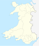
| Oversigtskort | |
Llanelli ("St Elli's Parish") er en købstad og det største community i Carmarthenshire og grevskabet Dyfed, Wales. Den ligger ved floden Loughors udmunding[1] omkring 17 km nordvest for Swansea og 19 km sydøst for county-byen Carmarthen. Llanelli havde et befolkningstal på 25.168 i 2011, og et estimeret indbyggertal på 26.225 i 2019,[2] hvilket gør den til en af Wales' største byer. Den lokalet myndighed var Llanelli Borough Council da countiet Dyfed eksisterede, men det har været en del af Carmarthenshire County Council siden 1996.[3]
Referencer
- ^ Chisholm, Hugh, red. (1911). . Encyclopædia Britannica. Vol. 16 (11. udgave). Cambridge University Press. s. 829.
- ^ City Population. Retrieved 14 January 2021.
- ^ Skabelon:NOMIS2011
Eksterne henvisninger
| Spire |
|
Medier brugt på denne side
Forfatter/Opretter: NordNordWest, Licens: CC BY-SA 3.0
Location map of Wales, United Kingdom
Forfatter/Opretter:
- Wales_location_map.svg: NordNordWest
- Flag_of_Wales_2.svg:
- derivative work: Fry1989 eh? 20:04, 8 December 2011 (UTC)
Flag map of Wales
(c) Hywel Williams, CC BY-SA 2.0
Llanelli Town Hall (Recreated) This is a recreation of the following 1955 picture from the Frith collection: http://www.francisfrith.com/search/wales/dyfed/llanelli/photos/llanelli_L73057.htm There's remarkably little difference between the two photographs. The trees behind the spot the picture was taken have obviously grown, the cars are more modern and the little chair on which the lady is sitting in 1955 is no longer there.


