Lingèvres
| Lingèvres – fransk kommune (commune) – | |||
|---|---|---|---|
| |||
 Church in Lingèvres | |||
| Land | |||
| Region | |||
| Departement | Calvados | ||
| Arrondissement | Bayeux | ||
| Kanton | Balleroy | ||
| Interkommunal enhed | Communauté de communes Villers-Bocage Intercom | ||
| Geografi | |||
| Koordinater | 49°10′32″N 0°40′18″V / 49.17556°N 0.67167°VKoordinater: 49°10′32″N 0°40′18″V / 49.17556°N 0.67167°V | ||
| Højde (gns) | 90 m | ||
| Areal | 14,46 km² | ||
| Demografi | |||
| Indbyggere | 491 | ||
| Befolkningstæthed | 34 indb./km² | ||
| Postnummer | 14250 | ||
| INSEE-kode | 14364 | ||
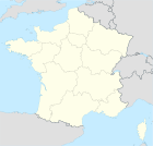
 Kort over kommunen | |||
Lingèvres er en kommune i Calvados departmentet i Basse-Normandie regionen i det nordvestlige Frankrig.
Eksterne kilder/henvisninger
- Lingèvres på l'Institut géographique national Arkiveret 13. marts 2007 hos Wayback Machine
| Spire Denne artikel om Frankrigs geografi er en spire som bør udbygges. Du er velkommen til at hjælpe Wikipedia ved at udvide den. |
Medier brugt på denne side
Map showing France with the ch flag.
Forfatter/Opretter: Zorlot, Licens: CC BY-SA 4.0
Flag of Lower Normandy (Basse-Normandie)
Forfatter/Opretter: Ikmo-ned, Licens: CC BY-SA 4.0
Lingèvres (Normandie, France). L'église Saint-Martin.
Forfatter/Opretter:
|
Map data (c) OpenStreetMap contributors, CC-BY-SA  • Shape files infrastructure: railway, highways, water: all originally by OpenStreetMap contributors. Status december 2011 *note: shown commune boundaries are from OSM dump May 2012; at that time about 90% complete |
Map commune FR insee code 14364.png


