Liévin
| Liévin – fransk kommune (commune) – | |||||
|---|---|---|---|---|---|
| |||||
 Hejseværk fra en nu nedlagt kulmine i Liévin | |||||
| Land | |||||
| Region | |||||
| Departement | Pas-de-Calais | ||||
| Arrondissement | Lens | ||||
| Kanton | Canton de Liévin-Nord/Canton de Liévin-Sud | ||||
| Interkommunal enhed | Communaupole de Lens-Liévin | ||||
| Geografi | |||||
| Koordinater | 50°25′22″N 02°46′43″Ø / 50.42278°N 2.77861°ØKoordinater: 50°25′22″N 02°46′43″Ø / 50.42278°N 2.77861°Ø | ||||
| Højde (gns) | 50 m | ||||
| Areal | 12,83 km² | ||||
| Demografi | |||||
| Indbyggere | 31.790 | ||||
| Befolkningstæthed | 2.478 indb./km² | ||||
| Postnummer | 62800 | ||||
| INSEE-kode | 62510 | ||||
| Hjemmeside | lievin.fr | ||||
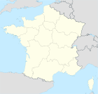
 Kort over kommunen | |||||
Liévin er en kommune, der ligger i det franske departement Pas-de-Calais i det nordlige Frankrig. Kommunen har et areal på 12,83 km² og et indbyggertal på 33.022 pr. 2006. Den ligger i nærheden af Lens.
Kommunen er præget af, at egnen tidligere var et stort kulminedistrikt. Gravningen af kullet begyndte i 1857, og den sidste mine lukkede i 1974, efter at en ulykke kostede 42 minearbejdere livet.
Eksterne henvisninger
- Officiel hjemmeside (fransk)
| Spire Denne artikel om Frankrigs geografi er en spire som bør udbygges. Du er velkommen til at hjælpe Wikipedia ved at udvide den. |
|
Medier brugt på denne side
Forfatter/Opretter: Patricia.fidi, Licens: CC0
"Lion of Flandres appearing", used on the flag of the Belgian Flanders (located partly in the west of Belgium). It is also sometimes used for French Flanders (western department of northern France). Artois and Hainault (adjacent to this area) have different flags, as well as the Nord-Pas-de-Calais)
Map showing France with the ch flag.
Forfatter/Opretter:
|
Map data (c) OpenStreetMap contributors, CC-BY-SA • Shape files infrastructure: railway, highways, water: all originally by OpenStreetMap contributors. Status december 2011 *note: shown commune boundaries are from OSM dump May 2012; at that time about 90% complete |
Map commune FR insee code 62510.png
Forfatter/Opretter: Jérémy Jännick, Licens: CC0
Dette billede er lagt op som en del af Wiki Loves Monuments 2011.
Forfatter/Opretter: Chatsam, Licens: CC BY-SA 3.0
blason de la commune de liévin, pas de calais, france :fascé d’argent et de gueules de 8 pièces.
Forfatter/Opretter: Patricia.fidi, Licens: CC0
"Lion of Flandres appearing", used on the flag of the Belgian Flanders (located partly in the west of Belgium). It is also sometimes used for French Flanders (western department of northern France). Artois and Hainault (adjacent to this area) have different flags, as well as the Nord-Pas-de-Calais)
Blason (non-officiel attendu que ce département ne revendique aucun blason) du département du Pas-de-Calais : d’azur semé de fleurs de lys d’or et brisé en chef d’un lambel de gueules de trois pendants chargés chacun de trois petits châteaux aussi d’or rangés en pal, à la bordure du même chargée de trois tourteaux de gueules


