Lend (Graz)
 For alternative betydninger, se Lend (flertydig). (Se også artikler, som begynder med Lend)
| Lend | |||||
|---|---|---|---|---|---|
| |||||
 Eiserne Haus og Kunsthaus Graz ved Südtiroler Platz | |||||
| Overblik | |||||
| Land | |||||
| Delstat | Steiermark | ||||
| By | Graz | ||||
| Postnr. | 8020, 8051 | ||||
| Demografi | |||||
| Indbyggere[1] | 32.476 (2019) | ||||
| Andet | |||||
| Tidszone | UTC +1 | ||||
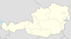
| Oversigtskort | |||||
Lend er bydel nr. 4 i Graz, Østrig.[2] Den ligger centralt på vestbredden af floden Mura og indeholder bl.a. hovedbanegården. Bydelen afgrænses i vest af Alte Poststraße, i syd af Annenstraße og i nord af Grazer Kalvarienberg.
Steder i Lend
- Lendplatz og Südtiroler Platz - de centrale pladser
- Kunsthaus Graz - museum for moderne kunst
- Graz Hauptbahnhof - hovedbanegården
- Barmherzigenkirche
- Grazer Kalvarienberg - en kristen helligdom til minde om Jesu korsfæstelse på Golgata
- Mariahilfer Kirche
- Marienkirche
- Roseggerhaus
- Orpheum - teater grundlagt i 1899 som modvægt til Graz' operahus
- p.p.c.-Project Pop Culture
- Rondo
Kildehenvisninger
- ^ "Zahlen + Fakten: Bevölkerung, Bezirke, Wirtschaft, Geografie" (tysk). graz.at. Hentet 2. august 2020.
- ^ "Die Bezirksvertretungen" (tysk). graz.at. Hentet 2. august 2020.
|
Medier brugt på denne side
Flag of Austria with the red in the Austrian national colours which was official ordered within the Austrian Armed Forces (Bundesheer) in the characteristic “Pantone 032 C” (since May 2018 the Red is ordered in the characteristic “Pantone 186 C”.)
Forfatter/Opretter: E.mil.mil (talk), Licens: CC BY-SA 3.0 at
Sogen. Eisernes Haus
Forfatter/Opretter: Mitte (talk), Licens: CC BY-SA 3.0 at
Markthalle, Lendplatz, Graz, Österreich
Forfatter/Opretter: Ralf Roletschek, Licens: GFDL 1.2
Graz am Abend
Forfatter/Opretter: Lencer, Licens: CC BY-SA 3.0
Location map of Austria
Equirectangular projection, N/S stretching 150 %. Geographic limits of the map:
- N: 49.2° N
- S: 46.3° N
- W: 9.4° E
- E: 17.2° E


