Lansing
| Lansing Lansing | |
|---|---|
| Overblik | |
| Land | |
| Borgmester | Andy Schor[1] |
| Grundlagt | 1835 |
| Postnr. | 48901–48980 |
| Telefonkode | 517 |
| UN/LOCODE | USLAN |
| Demografi | |
| Indbyggere | 112.644 (2020)[2] |
| Andet | |
| Tidszone | UTC-05:00 (normaltid) UTC-04:00 (sommertid) |
| Højde m.o.h. | 262 m |
| Hjemmeside | www.lansingmi.gov |
| Oversigtskort | |
Lansing er hovedstad i den amerikanske delstat Michigan. Byen har 112.644 (2020)[2] indbyggere.

Referencer
- ^ www.lansingmi.gov, hentet 25. marts 2022 (fra Wikidata).
- ^ a b United States Census Bureau, hentet 1. januar 2022.
QuickFacts, United States Census Bureau, hentet 22. august 2023.
United States Census Bureau, hentet 22. august 2023 (fra Wikidata).
Ekstern henvisning
- Lansing, Michigan – officiel website (engelsk) Arkiveret 24. september 2011 hos Wayback Machine
| Spire |
Medier brugt på denne side
USA Flag Map.svg
(c) Lokal_Profil, CC BY-SA 2.5
Map showing Mainland USA ("lower 48") with a superimposed US flag.
(c) Lokal_Profil, CC BY-SA 2.5
Map showing Mainland USA ("lower 48") with a superimposed US flag.
1 Lansing Pan cropped.jpg
(c) Criticalthinker, CC BY-SA 3.0
Cropped version of 1_Lansing_Pan.jpg. This version removes the focus from the large building in the foreground of the original.
(c) Criticalthinker, CC BY-SA 3.0
Cropped version of 1_Lansing_Pan.jpg. This version removes the focus from the large building in the foreground of the original.
USA Michigan location map.svg
Forfatter/Opretter: Alexrk2, Licens: CC BY 3.0
Grafik blev lavet med GeoTools. .
Forfatter/Opretter: Alexrk2, Licens: CC BY 3.0
Grafik blev lavet med GeoTools. .
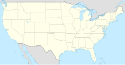
USA location map.svg
Forfatter/Opretter: NordNordWest, Licens: CC BY-SA 3.0
Location map of the United States ("lower 48")
Forfatter/Opretter: NordNordWest, Licens: CC BY-SA 3.0
Location map of the United States ("lower 48")


