Landeck
| Landeck | |
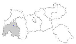
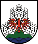
| Våben | Beliggenhed |
| Administration | |
| Land | |
|---|---|
| Forbundsland: | Tyrol |
| Borgmester | Engelbert Stenico (SPÖ) |
| Statistiske data | |
| Areal | 15,9 km² |
| Højde | 816 m |
| Indbyggere | 7.633 (31/12/2005) |
| - Tæthed | 480 Indb./km² |
| Andre informationer | |
| Tidszone | CET/CEST (UTC+1/UTC+2) |
| Nummerplade | LA |
| Postnr. | 6500 |
| Tlf.-forvalg | 05442 |
| Websted | www.landeck.tirol.gv.at |
| Koordinater | 47°08′00″N 10°34′00″Ø / 47.13333°N 10.56667°ØKoordinater: 47°08′00″N 10°34′00″Ø / 47.13333°N 10.56667°Ø |
| Landeck i Tyrol | |
Landeck er en by i den østrigske delstat Tyrol. Byen er forvaltningsstedet i distriktet af samme navn og har 7600 indbyggere (pr. 2005). Den ligger i en udvidelse af dalen til Inn, hvor denne svinger mod øst, og nærme indgangen til Paznaun- og Stanzer Tal.
På grund af Landecks beliggenhed må al trafik fra Innsbruck (dvs. fra øst) over både Arlberg- og Reschenpasset (dvs. vest- resp. sydover) passere byen.
|
Medier brugt på denne side
Forfatter/Opretter: Lencer, Licens: CC BY-SA 3.0
Location map of Austria
Equirectangular projection, N/S stretching 150 %. Geographic limits of the map:
- N: 49.2° N
- S: 46.3° N
- W: 9.4° E
- E: 17.2° E
Flag of Austria with the red in the Austrian national colours which was official ordered within the Austrian Armed Forces (Bundesheer) in the characteristic “Pantone 032 C” (since May 2018 the Red is ordered in the characteristic “Pantone 186 C”.)
Forfatter/Opretter: Data collected and hosted from: Niko Hofinger, Licens: LGPL
Map of Austria, position of the location
Forfatter/Opretter: Pflatsch, Licens: CC BY-SA 3.0
Stadtgemeinde Landeck in Tirol, Österreich. In der Bildmitte ist die Innbrücke der Arlbergbahn zu erkennen (Blick Richtung Westen)


