Kota Kinabalu
| Kota Kinabalu Kota Kinabalu | |||||
|---|---|---|---|---|---|
| |||||
 Urets retning fra venstre hjørne: 1Borneo, Tun Mustapha Tower, Wisma Tun Fuad Stephens, centrum af Kota Kinabalu og Wawasan Intersection. | |||||
| Overblik | |||||
| Land | |||||
| Borgmester | Datuk Abidin Madingkir | ||||
| Delstat | |||||
| Grundlagt | 1882 | ||||
| Demografi | |||||
| Kota Kinabalu | 452,058[1] (2010) | ||||
| - Areal | 351 km² | ||||
| Stor-Kota Kinabalu | 628,725 (2010) | ||||
| Andet | |||||
| Tidszone | UTC +8 | ||||
| Hjemmeside | www.dbkk.sabah.gov.my | ||||
| Oversigtskort | |||||
 Kota Kinabalu | |||||
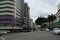
Kota Kinabalu, tidligere Jesselton, er hovedstad i Sabah, en af delstaterne i Malaysia, ligesom den er hovedstad for Sabah's West Coast Division. Kota Kinabalu ligger på nordvestkysten af øen Borneo ud mod Det Sydkinesiske Hav og Tunku Abdul Rahman Parken (med bl.a. den idylliske Gaya Island) på den ene side, og med bjerget Mount Kinabalu i Kinabalu Nationalpark i baggrunden på den anden side, strækker Kota Kinabalu sig langs flere kilometer kyststrækning samt stadig længere ind i landet. Med en anslået befolkning på 532.129 i selve byområdet og omkring 700.000 inkl. oplandet er Kot Kinabalu den største by i Sabah og den sjettestørste by i Malaysia.
Kota Kinabalu – der ofte blot betegnes som KK – er kendt nationalt og internationalt som et turistmæssigt gateway samt som en af de mest betydningsfulde adgangsveje for turister, der vil dybere ind i Sabah og Borneo. Kinabalu National Park ligger blot 90 km og 2 timers kørsel fra byen, ligesom der er mange turistmæssige seværdigheder i selve byen. Kota Kinabalu er – sammen med Kuching i Sarawak – samtidig ved at vokse til et stadig mere betydningsfuldt center for kommercielle og industrielle aktiviteter i Øst-Malaysia, hvad der er med til at gøre byen til en af de hurtigst voksende byer i Malaysia.
Referencer
Eksterne henvisninger
| Spire |
|
Medier brugt på denne side


Flag of Kota Kinabalu municipality, Sabah, Malaysia.
- It has an image of Mount Kinabalu on it.
Forfatter/Opretter: Uwe Dedering, Licens: CC BY-SA 3.0
Location map of Malaysia.
Equirectangular projection. Strechted by 100.0%. Geographic limits of the map:
* N: 8.0° N
* S: 0.0° N
* W: 99.0° E
* E: 120.0° E
Made with Natural Earth. Free vector and raster map data @ naturalearthdata.com.
Forfatter/Opretter: Ranking Update, Licens: CC BY 3.0
A composite image of icons of Kota Kinabalu from these images.
-
 Upload by Stefan Fussan
 -
 Upload by Cccefalon
 -
 Upload by Kawaputra
 -
-


Kota Kinabalu Emblem

Flag of the Malaysian state Sabah. Based on a GIF from a government website, colors from a photo. Drawn by Mysid. The flag was adopted September 16, 1988.
- The mountain on the left is Mount Kinabalu.
Per the Constitution of the State of Sabah:
"The State Flag is in a rectangular shape and is in the proportion of 1:2. The canton which extends at the head half way to the fly and 2/3 at the hoist to the foot is in Icicle Blue (C1T9) as the background to a graphic silhouette of Mount Kinabalu which is in Royal Blue (B10) positioned at ¼ of the height of the canton from end to end. The fly of the flag is divided equally into three bands of colours the foot division of which extends right to the hoist. The top band is in Zircon Blue (C5T5) the second band is in white and the third band is in Chili Red (S6R4)."