Kayangel
| Kayangel | ||
| Stat i Palau | ||
| ||
| Land | ||
|---|---|---|
| Areal | 1 km2 km² | |
| Indbyggertal | 54 | |

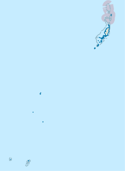
Kayangel[1][2] (Ngcheangel) er den nordligste delstat af Palau[3][4] 24 km nord for Koror. Landarealet er omkring 1,4 km2. Befolkningen var 54 i 2015.
Referencer
- ^ Olsudong, Rita (2006). Final Inventory of Historic Properties in Kayangel States, Republic of Palau (engelsk). Bureau of Arts and Culture, Palau Historic Preservation Office, Ministry of Community and Cultural Affairs.
- ^ Trust Territory of the Pacific Islands (engelsk). Bureau of International Organization Affairs, Office of United Nations Political Affairs.
- ^ Holyoak, Lorne (2005). Ethnographic and Oral History Survey of Kayangel State, Republic of Palau (engelsk). Palau Bureau of Arts and Culture and Historic Preservation Office, Ministry of Community and Regional Affairs.
- ^ Federal Information Processing Standards Publication (engelsk). U.S. Government Printing Office. 1994.
Medier brugt på denne side
Cargo drops from a U.S. Air Force C-130 Hercules aircraft over the Pacific Ocean toward a landing zone on the shore of Kayangel Island during the 62nd annual Operation Christmas Drop Dec. 11, 2013. Christmas Drop started in 1952 as a training mission and has since become the longest running Department of Defense mission in full operation as well as the longest running humanitarian airlift in the world.
Forfatter/Opretter: TUBS
Location of state xy (see filename) in Palau.


