Kalawao County
| Kalawao County, Hawaii | |
| Kort | |
 Placering i delstaten Hawaii | |
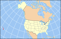
 Hawaiis placering i USA | |
| Basis data | |
| Grundlagt | 1905 |
|---|---|
| Hovedby | Ingen |
| Areal - I alt - Land - Vand | 136 km² 34 km² 101 km² |
| Befolkningstal - år 2010 Befolkningstæthed | 90 4 indb/km² |
Kalawao County er et county af i alt fem i den amerikanske delstat Hawaii. Kalawao County ligger på halvøen Kalaupapa på den nordlige kyst af øen Moloka'i.
Kalawao Countys totale areal er 136 km² hvoraf 101 km² er vand.
Det mindst folkerige county har et indbyggertal som blev estimeret til 86 (i 2019) - Kalawao County.[1]
I år 2000 var indbyggertallet 147 personer. Det er det mindste county i hele USA.
Referencer
- ^ "U.S. Census Bureau QuickFacts: Kalawao County, Hawaii". Census Bureau QuickFacts. 2019-07-01. Hentet 2020-04-02.
| ||||||||
Koordinater: 21°11′49″N 156°58′02″V / 21.196944444444°N 156.96722222222°V
|
Medier brugt på denne side
Map of USA with Hawaii highlighted and shown in true position
This is a locator map showing Kalawao County in Hawaii. For more information, see Commons:United States county locator maps.


