Jordskælvet i Chile 1960
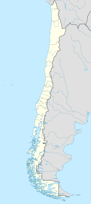
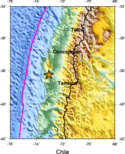
Epicenter og hovedstaden i Chile | |
| Dato | 22. maj 1960 |
|---|---|
| Tid | 19:11:14 UTC. |
| Varighed | Ca. 10 minutter |
| Styrke | 9.4–9.6 M [1] |
| Dybde | 33 km[2] |
| Epicenter | 38°17.4′S 73°3.0′V / 38.2900°S 73.0500°V |
| Type | 'Megathrust earthquake' |
| Lande og områder berørt | Chile - Stillehavsregionen |
| Døde | 1000-6000[3] |

Jordskælvet i Chile 1960, også kendt som jordskælvet i Valdivia, var et jordskælv, der fandt sted omkring Valdivia i Chile 22. maj 1960 kl. 19:11:14 UTC. Skælvet er med sin magnitude på 9,5 på Richterskalaen det kraftigste jordskælv, der nogensinde er registreret[4] og forårsagede omkring 2.000 menneskers død og 3.000 sårede.[5]
Præcis som ved jordskælvet i Det Indiske Ocean 2004 døde mange ikke af selve skælvet, men af den efterfølgende tsunami med op til 25 meter høje bølger. Tsunamien kunne måles over store dele af Stillehavskysten, ved Hilo og Hawaii, 10.000 km borte – og forårsagede over 10 meter høje bølger, der ødelagde dele af den kystnære bebyggelse. Også Japan og Filippinerne oplevede høje bølger ved kysterne.
Når der var så relativt få omkomne skyldtes det, at skælvet gik hårdest ud over store ubeboede områder i landet samt det faktum at størstedelen af husene var lavet af træ. Det betød, at husene blot 'dansede', når de blev udsat for skælvet.
Jordskælvet var et i en række af spektakulære skælv, der ramte Chile mellem 21. maj og 6. juni 1960. Vulkanen Cordón Caulle havde desuden et udbrud i den periode.
|
Referencer
- ^ Satake, K.; Atwater, B. (2007), "Long-Term Perspectives on Giant Earthquakes and Tsunamis at Subduction Zones" (PDF), Annual Review of Earth and Planetary Sciences, 35 (1): 355, Bibcode:2007AREPS..35..349S, doi:10.1146/annurev.earth.35.031306.140302, arkiveret (PDF) fra originalen 9. januar 2016, hentet 21. marts 2016
- ^ M 9.5 - 1960 Great Chilean Earthquake (Valdivia Earthquake) fra Usgs.gov har 25 km
- ^ USGS (4. september 2009), PAGER-CAT Earthquake Catalog, Version 2008_06.1, United States Geological Survey, arkiveret fra originalen 2020-03-13
- ^ Liste med store jordskælv, 'megathrust earthquakes'
- ^ The Largest Earthquake in the World. USGS. Besøgt 26. oktober 2020. har "... More than 2,000 killed, 3,000 injured, 2,000,000 homeless ..."
Eksterne henvisninger
- M 9.5 - 1960 Great Chilean Earthquake (Valdivia Earthquake) fra Usgs.gov
Medier brugt på denne side
Forfatter/Opretter: Mikenorton, Licens: CC BY-SA 3.0
Bull's eye graphic for use with earthquake location maps
Forfatter/Opretter: Felanox, Licens: CC BY-SA 3.0
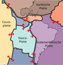
Sceme of Subduction (in German)
Volcanic arcs and oceanic trenches partly encircling the Pacific Basin form the so-called Pacific Ring of fire, a zone of frequent earthquakes and volcanic eruptions. The trenches are shown in blue-green. The volcanic island arcs, although not labelled, are parallel to, and always landward of, the trenches. For example, the island arc associated with the Aleutian Trench is represented by the long chain of volcanoes that make up the Aleutian Islands. (SVG version of File:Pacific_Ring_of_Fire.png, recreated by Gringer using WDB vector data using code mentioned in File:Worldmap_wdb_combined.svg.)
Forfatter/Opretter: Buonasera, Licens: CC BY-SA 3.0
A boat was thrown by the tsunami wave in a house - Corral, in autumn 1960
Comparación entre terremotos recientes e históricos de acuerdo a la cantidad de energía liberada
The key principle of plate tectonics is that the lithosphere exists as separate and distinct tectonic plates, which float on the fluid-like (visco-elastic solid) asthenosphere. The relative fluidity of the asthenosphere allows the tectonic plates to undergo motion in different directions. This map shows 15 of the largest plates. Note that the Indo-Australian Plate may be breaking apart into the Indian and Australian plates, which are shown separately on this map. This is a cropped version.
The key principle of plate tectonics is that the lithosphere exists as separate and distinct tectonic plates, which float on the fluid-like (visco-elastic solid) asthenosphere. The relative fluidity of the asthenosphere allows the tectonic plates to undergo motion in different directions. This map shows 15 of the largest plates. Note that the Indo-Australian Plate may be breaking apart into the Indian and Australian plates, which are shown separately on this map.
Earthquake damage to good quality, wood-frame houses in Valdivia, Chile, 1960.


