Issy-les-Moulineaux
| Issy-les-Moulineaux – fransk kommune (commune) – | |||||
|---|---|---|---|---|---|
| |||||
 Forretningskvarteret i Issy-les-Moulineaux | |||||
| Land | |||||
| Region | |||||
| Departement | Hauts-de-Seine | ||||
| Arrondissement | Boulogne-Billancourt | ||||
| Interkommunal enhed | Communauté d'agglomération Grand-Paris-Seine-Ouest | ||||
| Borgmester | André Santini (fra 1980) | ||||
| Geografi | |||||
| Koordinater | 48°49′26″N 2°16′12″Ø / 48.82389°N 2.27000°ØKoordinater: 48°49′26″N 2°16′12″Ø / 48.82389°N 2.27000°Ø | ||||
| Højde (gns) | 63 m | ||||
| Areal | 4,25 km² | ||||
| Demografi | |||||
| Indbyggere | 65.326 | ||||
| Befolkningstæthed | 15.371 indb./km² | ||||
| Postnummer | 92130 | ||||
| INSEE-kode | 92040 | ||||
| Hjemmeside | www.issy.com | ||||
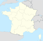
 Kort over kommunen | |||||
Issy-les-Moulineaux er en stor fransk provinsby. Den er beliggende i departementet Hauts-de-Seine.
Eksterne henvisninger
| Spire Denne artikel om Frankrigs geografi er en spire som bør udbygges. Du er velkommen til at hjælpe Wikipedia ved at udvide den. |
|
Medier brugt på denne side
Cultural flag for the region Île-de-France in France, based on the flag of the kingdom of France (s.XIV-XV). It is neither recognized nor used by public authorities of Île-de-France.
Cultural flag for the region Île-de-France in France, based on the flag of the kingdom of France (s.XIV-XV). It is neither recognized nor used by public authorities of Île-de-France.
Map showing France with the ch flag.
Map of Paris and its inner ring départements, localization of Issy-les-Moulineaux (Author: Metropolitan).
Forfatter/Opretter:
|
Map data (c) OpenStreetMap contributors, CC-BY-SA  • Shape files infrastructure: railway, highways, water: all originally by OpenStreetMap contributors. Status december 2011 *note: shown commune boundaries are from OSM dump May 2012; at that time about 90% complete |
Map of French municipality Issy-les-Moulineaux
Forfatter/Opretter: unknown, Licens: CC BY-SA 3.0


