Grauspitz
| Grauspitz | |
|---|---|
 | |
| Højeste punkt | |
| Højde | 2599 m |
| Primærfaktor | 371 m |
| Koordinater | 47°3′10″N 9°34′55″Ø / 47.05278°N 9.58194°ØKoordinater: 47°3′10″N 9°34′55″Ø / 47.05278°N 9.58194°Ø |
| Geografi | |
| Land | |
| Bjergområde | Rätikon, Alperne |
Grauspitz er det højeste bjerg i Liechtenstein med en højde på 2.599 moh, og er beliggende i bjergkæde Rätikon i Alperne. Bjergets top består af to tinder: Hintergrauspitz (2.574 m) og Vordergrauspitz (2.599 m).
| Spire |
Medier brugt på denne side
a map symbol for a mountain, the center is in the middle of the base line - as opposed to Fire.svg
Flag of Liechtenstein
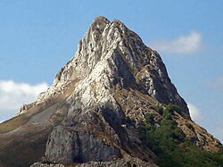
left to right: Vorder Grauspitz (Rätikon, CH/FL, 2599 m), the highest mountain in Liechtenstein and Hinter Grauspitz (also: Schwarzhorn) (2574m) from east.
Forfatter/Opretter: Eric Gaba (Sting - fr:Sting) and NordNordWest, Licens: CC BY-SA 3.0
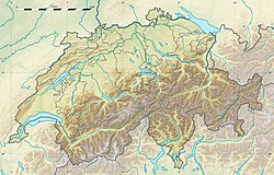
Blank physical map of Switzerland, for geo-location purpose. More maps: → Maps of Switzerland.
Forfatter/Opretter: Original image: Óscar Ibáñez Fernández (diskussion · bidrag)
Edited version: ArtMechanic (diskussion · bidrag), Licens: CC BY-SA 3.0
Gilbo Peak, near Riaño, in the province of León, Spain.


