Gonaïves
| Gonaïves | |
|---|---|
 | |
| Overblik | |
| Land | |
| Demografi | |
| Indbyggere | 324.043 (2009)[1] |
| - Areal | 574 km² |
| - Befolkningstæthed | 565 pr. km² |
| Andet | |
| Højde m.o.h. | 6 m |
| Oversigtskort | |
Gonaïves er en by på det nordlige Haiti, med et indbyggertal på 324.043 (2009)[1]. Byen er hovedstad i departementet Artibonite og ligger på landets kyst til det Caribiske hav.
Kildeangivelser
- ^ a b www.ihsi.ht (fra Wikidata).

|
| Spire |
Medier brugt på denne side
The national and official state flag of Haiti; arms obtained from File:Coat of arms of Haiti.svg. The civil flag can be found at here.
Forfatter/Opretter:
- Haiti_locator_map.svg: Jackaranga
- derivative work: Fry1989 (talk)
Flag map of Haiti
Forfatter/Opretter: Roosewelt Pinheiro/ABr, Licens: CC BY 3.0 br
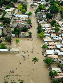
Gonaives, Haiti.
Image of the flood waters in Gonaïves, Haiti after Hurricane Jeanne
Forfatter/Opretter: Jackaranga, Licens: CC BY-SA 3.0
Locator map of Haiti, using the standard colours from fr:Aide:Cartographie, and a plate carré projection. Map boundaries:
West: -74.614641 East: -71.387348 North: 20.33042
South: 17.818522


