Finsch (månekrater)
| Månekrater | ||
|---|---|---|
| Finsch | ||
 Finschkrateret | ||
| Karakteristika | ||
| Bredde Længde | [1][2] | |
| Diameter | 4 km [1][2] | |
| Dybde | ukendt [3][4] | |
| 339° [4] | ||
| Opkaldt efter | Otto F.H. Finsch [2][5][3] | |
| Fra periode | ukendt [4][6] | |
| Kraterets placering | ||
| Månen - Selenografi - () | ||
Find flere artikler om astronomi på Astronomiportalen | ||
Finsch er et mindre nedslagskrater på Månen med en diameter på 4 km. Det befinder sig på Månens forside og er opkaldt efter den tyske zoolog Otto F.H. Finsch (1839 – 1917).
Navnet blev officielt tildelt af den Internationale Astronomiske Union (IAU) i 1976. [2][5][7]
Omgivelser
Finschkrateret ligger i den midterste del af Mare Serenitatis, syd-sydøst for Sarabhaikrateret. [8]
Karakteristika
Krateret er blevet helt dækket af materiale fra maret, så det danner et spøgelseskrater i lavasletten.
Måneatlas
Se også
- Månekratere – Liste over kratere på Månen
- Navne på Månens have – Liste over have på Månen
| |||||||||||||
| |||||||||||||||||||||||||||||||||
Kilder
- ^ a b NASAs side om månekratere:"Moon nomenclature -Crater". The Lunar Prospector Website, NASA Ames Research Center. Arkiveret fra originalen 22. marts 2009. Hentet 23. marts 2009. (engelsk)
- ^ a b c d Deskriptive data om månekratere på hjemmesiden fra USAs geologiske institut. ( Klik på det relevante navn ) :"Gazetteer of Planetary Nomenclature - Moon Nomenclature: Crater, craters". Astrogeology Research Program, U.S. Geological Survey. Arkiveret fra originalen 7. marts 2010. Hentet 2007-08-05. (engelsk)
- ^ a b Finsch på Wikien The Moon Arkiveret 1. marts 2018 hos Wayback Machine (engelsk)
- ^ a b c Program (under GNU-licens) og integreret database:"Atlas Virtuel de la Lune". Portail de l'Astronomie en France af Patrick Chevalley og Christian Legrand. Arkiveret fra originalen 14. maj 2008. Hentet 23. marts 2009. (fransk)
- ^ a b Liste over officielle navne på månekratere fra en tysk astronomihjemmeside :"Krater mit individuellem Namen (Kratere med individuelle navne)". www.astrolink.de. Arkiveret fra originalen 11. februar 2006. Hentet 23. marts 2009. (tysk)
- ^ Tompkins, S. & C.M. Pieters (1999). Meteoritics & Planetary Science, vol. 34, no. 1, side 25-41 (red.). Mineralogy of the lunar crust: Results from Clementine. Arkiveret fra originalen 31. maj 2018. Hentet 20. januar 2021.
{{cite book}}: CS1-vedligeholdelse: Flere navne: editors list (link) (i pdf- eller gif-format). (engelsk) - ^ I almindelighed tildelte IAU officielle navne til kratere på Månens forside i 1935, til kratere på Månens bagside i 1970, og endelig har visse mindre kratere (der tidligere ansås som satellitkratere) fået nye navne fra 1973 og fremefter. Se :
- USAs geologiske undersøgelser :"Gazetteer of Planetary Nomenclature - History of Planetary Nomenclature". Astrogeology Research Program, U.S. Geological Survey. Arkiveret fra originalen 9. august 2014. Hentet 23. marts 2009. (engelsk)
- Mario Tessier (1998). "La cartographie lunaire: des origines au XXeme siècle (Månens kartografi: Fra begyndelsen til 20. århundrede)". Nox Oculis. Arkiveret fra originalen 5. december 2008. Hentet 23. marts 2009.
{{cite web}}: Ekstern henvisning i|author=
- ^ http://www.lpi.usra.edu/resources/lunar_orbiter/images/aimg/iv_085_h3.jpgLpi-måneatlas
Eksterne henvisninger
( )
- 1) Henvisninger, som specielt retter sig mod Finsch
(Bemærk, at kraternavne med specialkarakter, herunder mellemrum, kan kræve søgning på de nævnte internetsider)
- Billeder af stedet i flere udgaver, baseret på optagelser fra sonden Clementine (1994) og vist på http://pdsmaps.wr.usgs.gov/ Map-a-Planet (Astrogeology Research Program), U.S. Geological Survey:
- Monokromt (et bånd ved bølgelængde på 750 nanometer giver et sort/hvidt billede;
- Naturlige farver (fem bølgelængder: 415, 750, 900, 950 og 1000 nanometer);
- Kunstige farver (Blå og grønne er de lavestliggende områder, røde og grønne de højere);
- Relieffarver (viser topografien i farverne rød (750 nm/415 nm), grøn (750 nm/950 nm) og blå (414 nm/750 nm) i en farveblanding, som fjerner dominerende klarhedsfaktorer som albedo og skyggevirkninger. Se også farveindexet).
- En nærmere forklaring på den anvendte fotografiske teknik findes på denne hjælpeside (engelsk).
- "Præcis beliggenhed og overblik over stedet". www.geody.com/?world=moon Geody - søgemaskine for steder på Merkur, Venus, Jorden, Månen, Mars og i rummet (støttet af Google Earth, NASA World Wind, Celestia og Stellarium. (hjemmeside under Creative Commons-licens , se http://www.geody.com/legal.php).
- Søgning af fotografier, kort og dokumentation vedrørende Finsch på"Lunar and Planetary Institutes søgemaskine". www.lpi.usra.edu/ (Hjemmeside for Lunar and Planetary Institute, Universities Space Research Association).(engelsk)
- 2) Generel information om overfladedannelser på Månen
- Deskriptive data og geologiske kort over detaljer på måneoverfladen ifølge IAU, vist på hjemmesiden fra USAs geologiske institut:"Gazetteer of Planetary Nomenclature - Moon Nomenclature Table Of Contents". planetarynames.wr.usgs.gov/ Astrogeology Research Program, U.S. Geological Survey (engelsk).
- NASAs side om månekratere:"Moon nomenclature -Crater". lunar.arc.nasa.gov/ The Lunar Prospector Website, NASA Ames Research Center. (engelsk)
- Wikiprojekt til samling af informationer om Månens overflade (The-Moon Wiki) på http://the-moon.wikispaces.com/. (engelsk)
- Program og integreret database på:Patrick Chevalley og Christian Legrand. "Atlas Virtuel de la Lune". www.astrosurf.com/ Portail de l'Astronomie en France. (fransk)
Bibliografi
( )
- Andersson, L. E.; Whitaker, E. A. (1982). NASA Catalogue of Lunar Nomenclature (NASAs katalog over månenomenklatur). NASA RP-1097.
- Bussey, B.; Spudis, P. (2004). The Clementine Atlas of the Moon (Clementine-atlas over Månen). New York: Cambridge University Press. ISBN 0-521-81528-2.
- Cocks, Elijah E.; Cocks, Josiah C. (1995). Who's Who on the Moon: A Biographical Dictionary of Lunar Nomenclature (Hvem er hvem på Månen: En biografisk ordbog over månenomenklatur). Tudor Publishers. ISBN 0-936389-27-3.
- McDowell, Jonathan (15. juli 2007). "Lunar Nomenclature (Månenomenklatur)". Jonathan's Space Report. Hentet 2007-10-24.
- Menzel, D. H.; Minnaert, M.; Levin, B.; Dollfus, A.; Bell, B. (1971). "Report on Lunar Nomenclature by The Working Group of Commission 17 of the IAU (Rapport over månenomenklatur fra arbejdsgruppen under kommission 17 hos IAU)". Space Science Reviews. 12: 136.
- Moore, Patrick (2001). On the Moon (På Månen). Sterling Publishing Co. ISBN 0-304-35469-4.
- Price, Fred W. (1988). The Moon Observer's Handbook (Månebetragterens håndbog). Cambridge University Press. ISBN 0521335000.
- Rükl, Antonín (1990). Atlas of the Moon (Måneatlas). Kalmbach Books. ISBN 0-913135-17-8.
- Webb, Rev. T. W. (1962). Celestial Objects for Common Telescopes (Himmelobjekter for almindelige teleskoper) (6th revision udgave). Dover. ISBN 0-486-20917-2.
- Whitaker, Ewen A. (1999). Mapping and Naming the Moon (Månens kortlægning og navngivning). Cambridge University Press. ISBN 0-521-62248-4.
- Wlasuk, Peter T. (2000). Observing the Moon (Måneobservation). Springer. ISBN 1-85233-193-3.
Medier brugt på denne side
Red dot
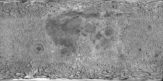
cylindrical map projection of the Moon. The Moon's whole surface was mapped by the Clementine spacecraft in 1994, here North is at the top. The dark floor of crater Plato is at the middle top above Mare Imbrium, while the bright floor and rays of crater Tycho is near the middle bottom below Mare Imbrium. Mare Procellarum is at the near left, and Mare Tranquillitatis is just right of centre and Mare Crisium is at the near right. The far left and far right show the contrast of the mostly cratered farside with small isolated mare.
Red dot, based on the image on en:.
Forfatter/Opretter: Rursus, Licens: CC BY-SA 3.0
Replacement for faulty
 (note the ring "around" Saturn!)
 Forfatter/Opretter: No machine-readable author provided. WikedKentaur assumed (based on copyright claims)., Licens: CC BY-SA 3.0
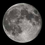
This is a stack of 10 frames taken through a 150mm Maksutov-Cassegrain telescope.
- Author: en:User:Mdf
- Source: en:Image:Moon-001.jpg 22:36, 14 July 2005 . . Mdf (
Oblique view facing north of Finsch crater in Mare Serenitatis, the moon. This image is based on to Figure 242 of Apollo Over the Moon: A View from Orbit (NASA SP-362), which has the following caption:
This picture, showing an area in central Mare Serenitatis 200 km from the nearest outcrops of terra rocks, is an oblique view of a 4-km diameter crater form about 200 m deep. The crater floor is similar to the surface of the surrounding mare, which is presumably mare basalt covered by 3 to 6 m of regolith. The rim of the crater is raised, although subdued; from this we infer that the present form was developed when mare lava flooded a normal impact crater that had formed on a lower, preexisting surface. The flooding basalt then subsided, more or less in proportion to its thickness, which was greatest inside the crater. The subsidence may have resulted from escape of bubbles from the lava while it was soft, thermal contraction of the lava, and compaction of an underlying relatively loosely packed regolith. Regolith compaction may have occurred when the load and heat of the flooding lava crushed irregular fragments of regolith into more compact shapes and plastically deformed the glassy components of the regolith into more compact shapes or into voids between other particles.


