Filippinernes regioner
Filippinerne er inddelt i 17 regioner, inkluderet hovedstadsområdet og nogen områder med særskilt politisk-retslig status. Regionerne er igen underinddelt i provinser.
Liste over regioner
Luzon
| Kort | Region (kort nanv) | Regionenhovedstad | komponerede lokale regeringsenheder - |
|---|---|---|---|
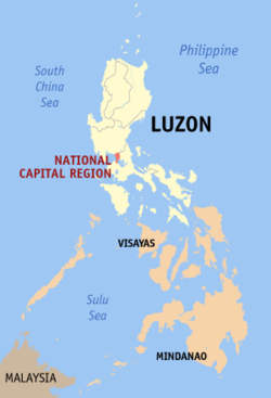
 | National Capital Region (NCR; Metro Manila) | Manila | |
(c) seav, CC BY-SA 3.0 | Cordillera Administrative Region (CAR) | Baguio City |
|
 | Ilocos Region (Region I) | San Fernando City, La Union |
|
(c) seav, CC BY-SA 3.0 | Cagayan Valley (Region II) | Tuguegarao City |
|
(c) seav, CC BY-SA 3.0 | Central Luzon (Region III) | San Fernando City, Pampanga |
|
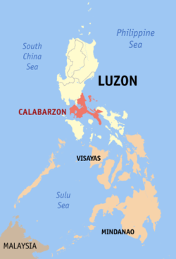
(c) seav, CC BY-SA 3.0 | CALABARZON (Region IV-A) | Calamba City |
|
(c) seav, CC BY-SA 3.0 | MIMAROPA (Region IV-B) | Calapan City |
|
(c) seav, CC BY-SA 3.0 | Bicol Region (Region V) | Legazpi City |
|
Visayas
| Kort | Region (kort nanv) | Regionenhovedstad | komponerede lokale regeringsenheder - |
|---|---|---|---|
(c) seal, CC BY-SA 3.0 | Western Visayas (Region VI) | Iloilo City | |
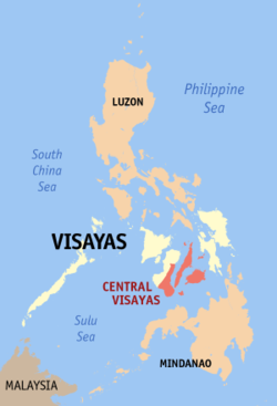
(c) seav, CC BY-SA 3.0 | Central Visayas (Region VII) | Cebu City | |
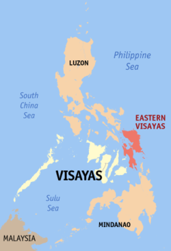
(c) seav, CC BY-SA 3.0 | Eastern Visayas (Region VIII) | Tacloban City |
Mindanao
| Kort | Region (kort nanv) | Regionenhovedstad | komponerede lokale regeringsenheder - |
|---|---|---|---|
(c) seav, CC BY-SA 3.0 | Zamboanga Peninsula (Region IX) | Pagadian City | |
(c) seav, CC BY-SA 3.0 | Northern Mindanao (Region X) | Cagayan de Oro City | |
(c) seav, CC BY-SA 3.0 | Davao Region (Region XI) | Davao City |
|
(c) seav, CC BY-SA 3.0 | SOCCSKSARGEN (Region XII) | Koronadal City |
|
(c) seav, CC BY-SA 3.0 | Caraga (Region XIII) | Butuan City |
|
 | Bangsamoro Autonomous Region of Muslim Mindanao (ARMM) | Cotabato City |
|
Referencer
- ^ a b c d e f g h i j k l m n o p q r s t u v w x y z aa ab ac ad ae af ag En by betegnet som "meget urbaniseret by", uafhængig fra alle provinser."Meget urbaniseret byer" har et minimumsbefolkning på 200.000 indbyggerog en årlig indkomst på mindst 50 millioner pesos baseret på låste priser fra 1991. Der er på nuværende tidspunkt (oktober 2009) 33 "meget urbaniseret byer" på Filippinerne, hvoraf 16 af dem ligger i Metro Manila.
- ^ En uafhængig kommune, ikke styret af nogen provins.
- ^ a b c d e Uafhængig komponent-by, ikke under nogen under domsmyndighed fra nogen provins-regering.
- ^ En komponent-by, del af provinsen Basilan
Medier brugt på denne side
(c) seav, CC BY-SA 3.0
Location map of the Davao Region in the southern Philippines.
- Within the Mindanao islands group super-region.
Forfatter/Opretter: MrHope, Licens: CC BY-SA 3.0
Map sowing the location of the Bangsamoro Autonomous Region in Muslim Mindanao (BARMM)
Forfatter/Opretter: unknown, Licens:
Satellite image of Philippines in March 2002.
Forfatter/Opretter: Eugene Alvin Villar (seav), Licens: CC BY-SA 3.0
Locator map of Metro Manila, the National Capital Region (NCR) in the Philippines.
(c) seav, CC BY-SA 3.0
Locator map of the Cordillera Administrative Region (CAR) in the Philippines


