Estoher
| Estoher – fransk kommune (commune) – | |||||
|---|---|---|---|---|---|
| |||||
 | |||||
| Land | |||||
| Region | |||||
| Departement | Occitanie | ||||
| Arrondissement | Prades | ||||
| Kanton | Le Canigou | ||||
| Interkommunal enhed | Communauté de communes Conflent-Canigó | ||||
| Borgmester | Louis Ques (fra 2014) | ||||
| Geografi | |||||
| Koordinater | 42°36′06″N 02°29′13″Ø / 42.60167°N 2.48694°ØKoordinater: 42°36′06″N 02°29′13″Ø / 42.60167°N 2.48694°Ø | ||||
| Højde (gns) | 390 m | ||||
| Areal | 26,08 km² | ||||
| Demografi | |||||
| Indbyggere | 155 | ||||
| Befolkningstæthed | 6 indb./km² | ||||
| Postnummer | 66320 | ||||
| INSEE-kode | 66073 | ||||
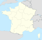
 Kort over kommunen | |||||
Estoher (catalansk: Estoer) er en by og kommune i departementet Pyrénées-Orientales i Sydfrankrig.
Geografi
Estoher ligger 42 km vest for Perpignan. Nærmeste by er mod nord Espira-de-Conflent (3 km).
Demografi
Udvikling i folketal
| |||||||||||||||||||||||||||
Kilder
Eksterne henvisninger
- Pyrénées Catalanes (fransk)
|
Medier brugt på denne side
Forfatter/Opretter:
|
Map data (c) OpenStreetMap contributors, CC-BY-SA • Shape files infrastructure: railway, highways, water: all originally by OpenStreetMap contributors. Status december 2011 *note: shown commune boundaries are from OSM dump May 2012; at that time about 90% complete |
Map of French municipality
Forfatter/Opretter: Jfblanc, Licens: CC BY-SA 4.0
Bandièra de la region administrativa francesa d'Occitània
Forfatter/Opretter: geni, Licens: CC BY 2.5
Flag of Languedoc-Roussillon
Forfatter/Opretter: Chatsam, Licens: CC BY-SA 3.0
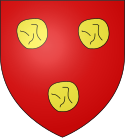
blason de la commune de Estoher : De gueules aux trois cailloux d’or.
Postcard showing Estoher in the early 20th century


