El Paso (Santa Cruz de Tenerife)
| El Paso El Paso | |||||
|---|---|---|---|---|---|
| |||||
 | |||||
| Overblik | |||||
| Land | |||||
| Autonom region | |||||
| Provins | |||||
| Ø | |||||
| Postnr. | 38750 | ||||
| Nummerpladebogstav(er) | TF | ||||
| Demografi | |||||
| Indbyggere | 8.156 (2024) | ||||
| - Areal | 136 km² | ||||
| - Befolkningstæthed | 60,0 pr. km² | ||||
| Andet | |||||
| Tidszone | UTC+1 | ||||
| Højde m.o.h. | 630 m | ||||
| Hjemmeside | www.elpaso.es | ||||
| Oversigtskort | |||||
| Kommunens beliggenhed på øen La Palma | |||||
(c) Miguillen, CC BY-SA 3.0 El Paso | |||||
El Paso er en by og kommune i det sydvestlige Spanien på øen La Palma i provinsen Santa Cruz de Tenerife, De Kanariske Øer. Den har et indbyggertal på 8.156 (2024) indbyggere.
Se også
Referencer
Eksterne henvisninger
| Spire |
Medier brugt på denne side
Bandera de la Comunidad Autónoma de Canarias (España)
Forfatter/Opretter: Germenfer, Licens: CC BY-SA 3.0
According to "Banderas y Escudos de las provincias de España", published by the Ministry for Public Administrations, the flag of the Province of Santa Cruz de Tenerife is blue with a white saltire and the provincial coat of arms in the middle.
(c) Miguillen, CC BY-SA 3.0
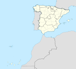
Location map of Spain with the Canary Islands
Forfatter/Opretter: NordNordWest, Licens: CC BY-SA 3.0
Location map of the Canary Islands, Spain
Forfatter/Opretter: jynus, Licens: CC BY-SA 3.0
Silhouette of Spain with Spanish Flag.
Flag of El Paso, Spain
Forfatter/Opretter: HansenBCN, Licens: CC BY-SA 3.0
Flag of La Palma island (Canary Islands, Spain), version with coat of arms.
Forfatter/Opretter: Michael Apel, Licens: CC BY-SA 3.0
View to the Caldera de Taburiente, La Palma, (Canary Islands, Spain).


